You are here: Home > Network List > US - United States National Seismic Network Stations List
> Station WMOK Wichita Mountains, Oklahoma, USA > Earthquake Result Viewer
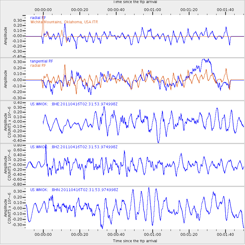
WMOK Wichita Mountains, Oklahoma, USA - Earthquake Result Viewer
*The percent match for this event was below the threshold and hence no stack was calculated.
| Earthquake location: |
Eastern Honshu, Japan |
| Earthquake latitude/longitude: |
36.4/139.7 |
| Earthquake time(UTC): |
2011/04/16 (106) 02:19:30 GMT |
| Earthquake Depth: |
77 km |
| Earthquake Magnitude: |
5.9 MB, 5.8 MW, 5.8 MW |
| Earthquake Catalog/Contributor: |
WHDF/NEIC |
|
| Network: |
US United States National Seismic Network |
| Station: |
WMOK Wichita Mountains, Oklahoma, USA |
| Lat/Lon: |
34.74 N/98.78 W |
| Elevation: |
486 m |
|
| Distance: |
90.7 deg |
| Az: |
44.568 deg |
| Baz: |
316.554 deg |
| Ray Param: |
$rayparam |
*The percent match for this event was below the threshold and hence was not used in the summary stack. |
|
| Radial Match: |
55.97417 % |
| Radial Bump: |
400 |
| Transverse Match: |
32.972523 % |
| Transverse Bump: |
400 |
| SOD ConfigId: |
356183 |
| Insert Time: |
2011-09-30 06:05:33.822 +0000 |
| GWidth: |
2.5 |
| Max Bumps: |
400 |
| Tol: |
0.001 |
|
Signal To Noise
| Channel | StoN | STA | LTA |
| US:WMOK: :BHZ:20110416T02:31:53.974998Z | 2.5282776 | 2.833419E-7 | 1.1206914E-7 |
| US:WMOK: :BHN:20110416T02:31:53.974998Z | 1.7912374 | 1.9060317E-7 | 1.0640867E-7 |
| US:WMOK: :BHE:20110416T02:31:53.974998Z | 2.2742004 | 1.8878669E-7 | 8.301233E-8 |
| Arrivals |
| Ps | |
| PpPs | |
| PsPs/PpSs | |


