You are here: Home > Network List > US - United States National Seismic Network Stations List
> Station CBKS Cedar Bluff, Kansas, USA > Earthquake Result Viewer
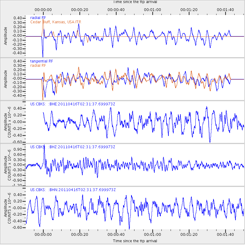
CBKS Cedar Bluff, Kansas, USA - Earthquake Result Viewer
*The percent match for this event was below the threshold and hence no stack was calculated.
| Earthquake location: |
Eastern Honshu, Japan |
| Earthquake latitude/longitude: |
36.4/139.7 |
| Earthquake time(UTC): |
2011/04/16 (106) 02:19:30 GMT |
| Earthquake Depth: |
77 km |
| Earthquake Magnitude: |
5.9 MB, 5.8 MW, 5.8 MW |
| Earthquake Catalog/Contributor: |
WHDF/NEIC |
|
| Network: |
US United States National Seismic Network |
| Station: |
CBKS Cedar Bluff, Kansas, USA |
| Lat/Lon: |
38.81 N/99.74 W |
| Elevation: |
677 m |
|
| Distance: |
87.3 deg |
| Az: |
42.31 deg |
| Baz: |
315.945 deg |
| Ray Param: |
$rayparam |
*The percent match for this event was below the threshold and hence was not used in the summary stack. |
|
| Radial Match: |
46.495186 % |
| Radial Bump: |
400 |
| Transverse Match: |
70.70254 % |
| Transverse Bump: |
400 |
| SOD ConfigId: |
356183 |
| Insert Time: |
2011-09-30 06:08:08.215 +0000 |
| GWidth: |
2.5 |
| Max Bumps: |
400 |
| Tol: |
0.001 |
|
Signal To Noise
| Channel | StoN | STA | LTA |
| US:CBKS: :BHZ:20110416T02:31:37.699973Z | 3.1013591 | 4.172859E-7 | 1.3454935E-7 |
| US:CBKS: :BHN:20110416T02:31:37.699973Z | 0.61596465 | 1.4357356E-7 | 2.3308735E-7 |
| US:CBKS: :BHE:20110416T02:31:37.699973Z | 1.2411128 | 1.4507111E-7 | 1.1688793E-7 |
| Arrivals |
| Ps | |
| PpPs | |
| PsPs/PpSs | |


