You are here: Home > Network List > UW - Pacific Northwest Regional Seismic Network Stations List
> Station MRBL Marblemount, WA, USA > Earthquake Result Viewer
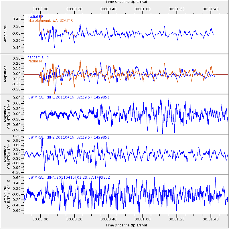
MRBL Marblemount, WA, USA - Earthquake Result Viewer
*The percent match for this event was below the threshold and hence no stack was calculated.
| Earthquake location: |
Eastern Honshu, Japan |
| Earthquake latitude/longitude: |
36.4/139.7 |
| Earthquake time(UTC): |
2011/04/16 (106) 02:19:30 GMT |
| Earthquake Depth: |
77 km |
| Earthquake Magnitude: |
5.9 MB, 5.8 MW, 5.8 MW |
| Earthquake Catalog/Contributor: |
WHDF/NEIC |
|
| Network: |
UW Pacific Northwest Regional Seismic Network |
| Station: |
MRBL Marblemount, WA, USA |
| Lat/Lon: |
48.52 N/121.48 W |
| Elevation: |
75 m |
|
| Distance: |
69.0 deg |
| Az: |
44.724 deg |
| Baz: |
301.336 deg |
| Ray Param: |
$rayparam |
*The percent match for this event was below the threshold and hence was not used in the summary stack. |
|
| Radial Match: |
52.93974 % |
| Radial Bump: |
400 |
| Transverse Match: |
57.180664 % |
| Transverse Bump: |
400 |
| SOD ConfigId: |
356183 |
| Insert Time: |
2011-09-30 06:18:19.746 +0000 |
| GWidth: |
2.5 |
| Max Bumps: |
400 |
| Tol: |
0.001 |
|
Signal To Noise
| Channel | StoN | STA | LTA |
| UW:MRBL: :BHZ:20110416T02:29:57.149985Z | 4.0311265 | 4.846916E-7 | 1.2023727E-7 |
| UW:MRBL: :BHN:20110416T02:29:57.149985Z | 1.6224685 | 1.9549887E-7 | 1.2049472E-7 |
| UW:MRBL: :BHE:20110416T02:29:57.149985Z | 1.7821167 | 2.3627692E-7 | 1.3258219E-7 |
| Arrivals |
| Ps | |
| PpPs | |
| PsPs/PpSs | |


