You are here: Home > Network List > AZ - ANZA Regional Network Stations List
> Station SMER AZ.SMER > Earthquake Result Viewer
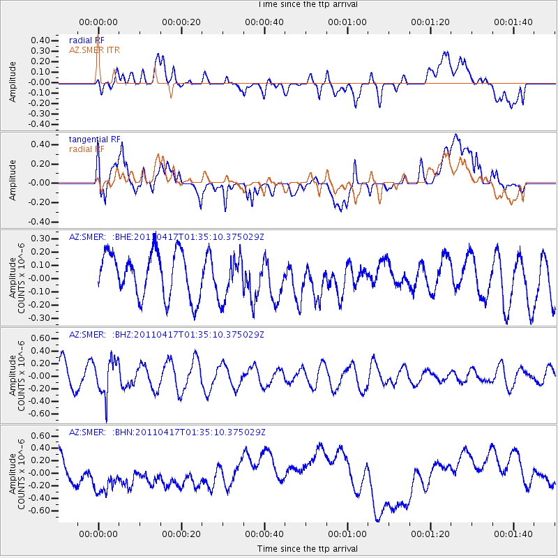
SMER AZ.SMER - Earthquake Result Viewer
*The percent match for this event was below the threshold and hence no stack was calculated.
| Earthquake location: |
Santiago Del Estero Prov., Arg. |
| Earthquake latitude/longitude: |
-27.6/-63.2 |
| Earthquake time(UTC): |
2011/04/17 (107) 01:24:33 GMT |
| Earthquake Depth: |
563 km |
| Earthquake Magnitude: |
5.6 MD, 5.1 MB |
| Earthquake Catalog/Contributor: |
WHDF/NEIC |
|
| Network: |
AZ ANZA Regional Network |
| Station: |
SMER AZ.SMER |
| Lat/Lon: |
33.46 N/117.17 W |
| Elevation: |
355 m |
|
| Distance: |
79.4 deg |
| Az: |
316.543 deg |
| Baz: |
133.109 deg |
| Ray Param: |
$rayparam |
*The percent match for this event was below the threshold and hence was not used in the summary stack. |
|
| Radial Match: |
21.900568 % |
| Radial Bump: |
400 |
| Transverse Match: |
30.752832 % |
| Transverse Bump: |
400 |
| SOD ConfigId: |
356183 |
| Insert Time: |
2011-09-30 06:31:16.598 +0000 |
| GWidth: |
2.5 |
| Max Bumps: |
400 |
| Tol: |
0.001 |
|
Signal To Noise
| Channel | StoN | STA | LTA |
| AZ:SMER: :BHZ:20110417T01:35:10.375029Z | 1.2954443 | 2.7754868E-7 | 2.1424981E-7 |
| AZ:SMER: :BHN:20110417T01:35:10.375029Z | 1.8284619 | 3.852606E-7 | 2.1070203E-7 |
| AZ:SMER: :BHE:20110417T01:35:10.375029Z | 0.9618477 | 1.6122446E-7 | 1.6761953E-7 |
| Arrivals |
| Ps | |
| PpPs | |
| PsPs/PpSs | |


