SMTC AZ.SMTC - Earthquake Result Viewer
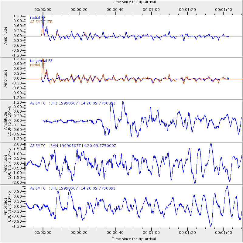
Earthquake location: Kodiak Island Region, Alaska
Earthquake latitude/longitude: 56.4/-152.9
Earthquake time(UTC): 1999/05/07 (127) 14:13:52 GMT
Earthquake Depth: 20 km
Earthquake Magnitude: 5.7 MB, 6.1 MS, 6.4 MW, 5.7 ME
Earthquake Catalog/Contributor: WHDF/NEIC
Network: AZ ANZA Regional Network
Station: SMTC AZ.SMTC
Lat/Lon: 32.94 N/115.80 W
Elevation: 100 m
Distance: 34.7 deg
Az: 116.802 deg
Baz: 323.849 deg
Ray Param: 0.07760097
Estimated Moho Depth: 20.25 km
Estimated Crust Vp/Vs: 1.62
Assumed Crust Vp: 6.155 km/s
Estimated Crust Vs: 3.799 km/s
Estimated Crust Poisson's Ratio: 0.19
Radial Match: 87.36115 %
Radial Bump: 400
Transverse Match: 73.43634 %
Transverse Bump: 400
SOD ConfigId: 32974
Insert Time: 2010-02-26 20:49:45.075 +0000
GWidth: 2.5
Max Bumps: 400
Tol: 0.001

Signal To Noise

ChannelStoNSTALTA
AZ:SMTC: :BHN:19990507T14:20:09.775009Z3.17316685.574611E-71.7567973E-7
AZ:SMTC: :BHE:19990507T14:20:09.775009Z1.6850212.1113146E-71.25299E-7
AZ:SMTC: :BHZ:19990507T14:20:09.775009Z7.7906753.5914513E-74.609936E-8
Arrivals
Ps2.2 SECOND
PpPs8.0 SECOND
PsPs/PpSs10 SECOND