You are here: Home > Network List > TA - USArray Transportable Network (new EarthScope stations) Stations List
> Station O33A Hebron, NE, USA > Earthquake Result Viewer
O33A Hebron, NE, USA - Earthquake Result Viewer
*The percent match for this event was below the threshold and hence no stack was calculated.
| Earthquake location: |
Santiago Del Estero Prov., Arg. |
| Earthquake latitude/longitude: |
-27.6/-63.2 |
| Earthquake time(UTC): |
2011/04/17 (107) 01:24:33 GMT |
| Earthquake Depth: |
563 km |
| Earthquake Magnitude: |
5.6 MD, 5.1 MB |
| Earthquake Catalog/Contributor: |
WHDF/NEIC |
|
| Network: |
TA USArray Transportable Network (new EarthScope stations) |
| Station: |
O33A Hebron, NE, USA |
| Lat/Lon: |
40.08 N/97.58 W |
| Elevation: |
480 m |
|
| Distance: |
74.6 deg |
| Az: |
333.278 deg |
| Baz: |
148.668 deg |
| Ray Param: |
$rayparam |
*The percent match for this event was below the threshold and hence was not used in the summary stack. |
|
| Radial Match: |
56.171146 % |
| Radial Bump: |
400 |
| Transverse Match: |
56.345444 % |
| Transverse Bump: |
400 |
| SOD ConfigId: |
356183 |
| Insert Time: |
2011-09-30 07:44:03.657 +0000 |
| GWidth: |
2.5 |
| Max Bumps: |
400 |
| Tol: |
0.001 |
|
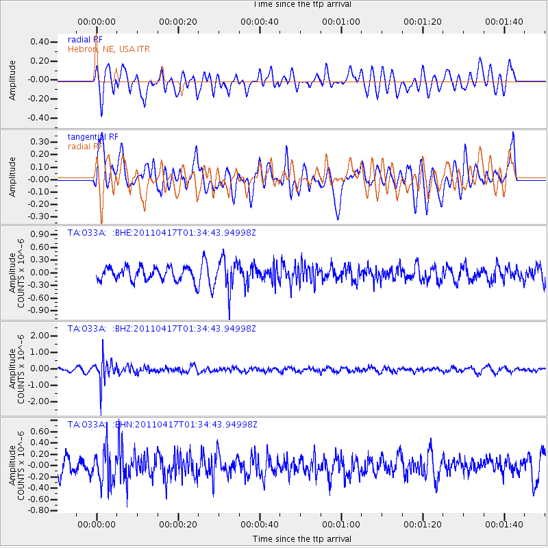
Signal To Noise
| Channel | StoN | STA | LTA |
| TA:O33A: :BHZ:20110417T01:34:43.94998Z | 7.4888372 | 7.1164476E-7 | 9.50274E-8 |
| TA:O33A: :BHN:20110417T01:34:43.94998Z | 2.0684025 | 3.0645748E-7 | 1.4816143E-7 |
| TA:O33A: :BHE:20110417T01:34:43.94998Z | 2.3247468 | 3.6309106E-7 | 1.5618521E-7 |
| Arrivals |
| Ps | |
| PpPs | |
| PsPs/PpSs | |


