You are here: Home > Network List > TA - USArray Transportable Network (new EarthScope stations) Stations List
> Station 136A Ennis, TX, USA > Earthquake Result Viewer
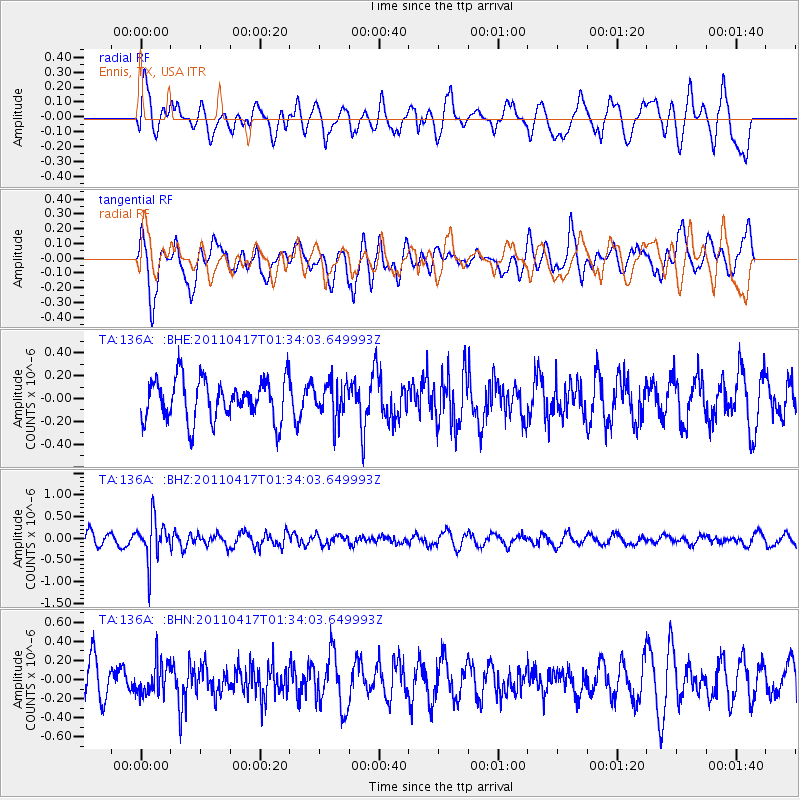
136A Ennis, TX, USA - Earthquake Result Viewer
*The percent match for this event was below the threshold and hence no stack was calculated.
| Earthquake location: |
Santiago Del Estero Prov., Arg. |
| Earthquake latitude/longitude: |
-27.6/-63.2 |
| Earthquake time(UTC): |
2011/04/17 (107) 01:24:33 GMT |
| Earthquake Depth: |
563 km |
| Earthquake Magnitude: |
5.6 MD, 5.1 MB |
| Earthquake Catalog/Contributor: |
WHDF/NEIC |
|
| Network: |
TA USArray Transportable Network (new EarthScope stations) |
| Station: |
136A Ennis, TX, USA |
| Lat/Lon: |
32.47 N/96.53 W |
| Elevation: |
113 m |
|
| Distance: |
67.7 deg |
| Az: |
329.85 deg |
| Baz: |
148.178 deg |
| Ray Param: |
$rayparam |
*The percent match for this event was below the threshold and hence was not used in the summary stack. |
|
| Radial Match: |
62.8005 % |
| Radial Bump: |
400 |
| Transverse Match: |
58.920834 % |
| Transverse Bump: |
400 |
| SOD ConfigId: |
356183 |
| Insert Time: |
2011-09-30 07:47:21.878 +0000 |
| GWidth: |
2.5 |
| Max Bumps: |
400 |
| Tol: |
0.001 |
|
Signal To Noise
| Channel | StoN | STA | LTA |
| TA:136A: :BHZ:20110417T01:34:03.649993Z | 2.9989471 | 4.7542815E-7 | 1.5853168E-7 |
| TA:136A: :BHN:20110417T01:34:03.649993Z | 1.0275446 | 1.7162131E-7 | 1.6702079E-7 |
| TA:136A: :BHE:20110417T01:34:03.649993Z | 0.8617944 | 1.5447621E-7 | 1.792495E-7 |
| Arrivals |
| Ps | |
| PpPs | |
| PsPs/PpSs | |


