You are here: Home > Network List > AZ - ANZA Regional Network Stations List
> Station SMTC AZ.SMTC > Earthquake Result Viewer
SMTC AZ.SMTC - Earthquake Result Viewer
| Earthquake location: |
Kuril Islands |
| Earthquake latitude/longitude: |
44.4/147.3 |
| Earthquake time(UTC): |
1999/01/09 (009) 03:05:37 GMT |
| Earthquake Depth: |
119 km |
| Earthquake Magnitude: |
5.8 MB, 5.8 MW, 5.6 MW |
| Earthquake Catalog/Contributor: |
WHDF/NEIC |
|
| Network: |
AZ ANZA Regional Network |
| Station: |
SMTC AZ.SMTC |
| Lat/Lon: |
32.94 N/115.80 W |
| Elevation: |
100 m |
|
| Distance: |
72.2 deg |
| Az: |
61.231 deg |
| Baz: |
311.635 deg |
| Ray Param: |
0.05349471 |
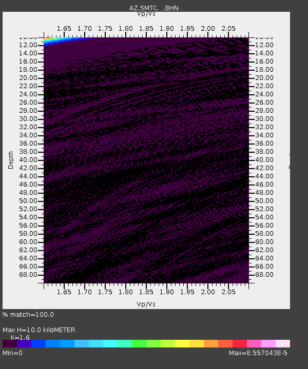
| Estimated Moho Depth: |
10.0 km |
| Estimated Crust Vp/Vs: |
1.60 |
| Assumed Crust Vp: |
6.155 km/s |
| Estimated Crust Vs: |
3.847 km/s |
| Estimated Crust Poisson's Ratio: |
0.18 |
|
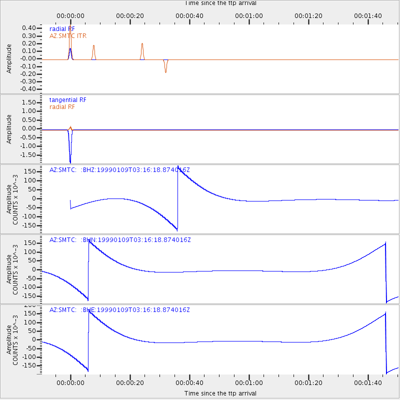
| Radial Match: |
100.0 % |
| Radial Bump: |
2 |
| Transverse Match: |
100.0 % |
| Transverse Bump: |
2 |
| SOD ConfigId: |
9875 |
| Insert Time: |
2010-02-26 20:49:58.940 +0000 |
| GWidth: |
2.5 |
| Max Bumps: |
400 |
| Tol: |
0.001 |
|
Signal To Noise
| Channel | StoN | STA | LTA |
| AZ:SMTC: :BHN:19990109T03:16:18.874016Z | 6.2775126 | 0.095239565 | 0.015171546 |
| AZ:SMTC: :BHE:19990109T03:16:18.874016Z | 6.2775974 | 0.098622985 | 0.015710307 |
| AZ:SMTC: :BHZ:19990109T03:16:18.874016Z | 6.2775774 | 0.098849244 | 0.0157464 |
| Arrivals |
| Ps | 1.0 SECOND |
| PpPs | 4.1 SECOND |
| PsPs/PpSs | 5.1 SECOND |


