You are here: Home > Network List > TA - USArray Transportable Network (new EarthScope stations) Stations List
> Station K31A O'Neill, NE, USA > Earthquake Result Viewer
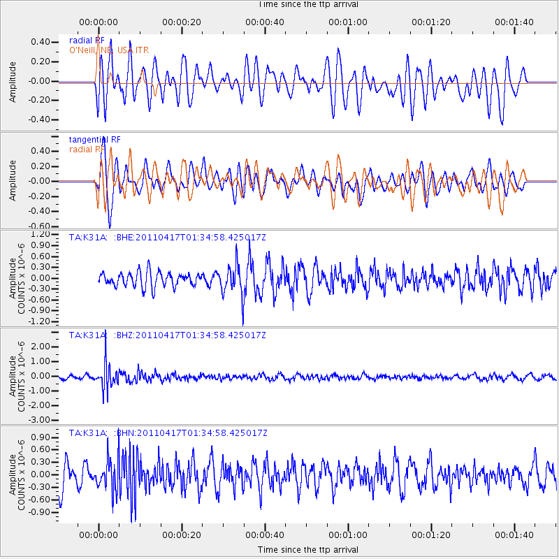
K31A O'Neill, NE, USA - Earthquake Result Viewer
*The percent match for this event was below the threshold and hence no stack was calculated.
| Earthquake location: |
Santiago Del Estero Prov., Arg. |
| Earthquake latitude/longitude: |
-27.6/-63.2 |
| Earthquake time(UTC): |
2011/04/17 (107) 01:24:33 GMT |
| Earthquake Depth: |
563 km |
| Earthquake Magnitude: |
5.6 MD, 5.1 MB |
| Earthquake Catalog/Contributor: |
WHDF/NEIC |
|
| Network: |
TA USArray Transportable Network (new EarthScope stations) |
| Station: |
K31A O'Neill, NE, USA |
| Lat/Lon: |
42.62 N/98.75 W |
| Elevation: |
580 m |
|
| Distance: |
77.2 deg |
| Az: |
333.881 deg |
| Baz: |
148.045 deg |
| Ray Param: |
$rayparam |
*The percent match for this event was below the threshold and hence was not used in the summary stack. |
|
| Radial Match: |
65.098595 % |
| Radial Bump: |
400 |
| Transverse Match: |
66.53172 % |
| Transverse Bump: |
400 |
| SOD ConfigId: |
356183 |
| Insert Time: |
2011-09-30 08:00:36.318 +0000 |
| GWidth: |
2.5 |
| Max Bumps: |
400 |
| Tol: |
0.001 |
|
Signal To Noise
| Channel | StoN | STA | LTA |
| TA:K31A: :BHZ:20110417T01:34:58.425017Z | 5.6864386 | 8.398367E-7 | 1.4769115E-7 |
| TA:K31A: :BHN:20110417T01:34:58.425017Z | 1.2991556 | 3.887239E-7 | 2.9921273E-7 |
| TA:K31A: :BHE:20110417T01:34:58.425017Z | 2.1576595 | 4.2026502E-7 | 1.9477818E-7 |
| Arrivals |
| Ps | |
| PpPs | |
| PsPs/PpSs | |


