You are here: Home > Network List > TA - USArray Transportable Network (new EarthScope stations) Stations List
> Station S39A Bolivar, MO, USA > Earthquake Result Viewer
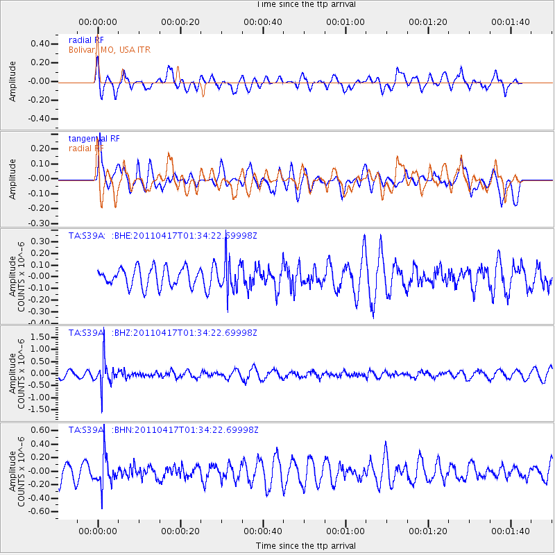
S39A Bolivar, MO, USA - Earthquake Result Viewer
*The percent match for this event was below the threshold and hence no stack was calculated.
| Earthquake location: |
Santiago Del Estero Prov., Arg. |
| Earthquake latitude/longitude: |
-27.6/-63.2 |
| Earthquake time(UTC): |
2011/04/17 (107) 01:24:33 GMT |
| Earthquake Depth: |
563 km |
| Earthquake Magnitude: |
5.6 MD, 5.1 MB |
| Earthquake Catalog/Contributor: |
WHDF/NEIC |
|
| Network: |
TA USArray Transportable Network (new EarthScope stations) |
| Station: |
S39A Bolivar, MO, USA |
| Lat/Lon: |
37.69 N/93.32 W |
| Elevation: |
331 m |
|
| Distance: |
70.8 deg |
| Az: |
335.066 deg |
| Baz: |
151.865 deg |
| Ray Param: |
$rayparam |
*The percent match for this event was below the threshold and hence was not used in the summary stack. |
|
| Radial Match: |
57.316673 % |
| Radial Bump: |
400 |
| Transverse Match: |
66.90738 % |
| Transverse Bump: |
400 |
| SOD ConfigId: |
356183 |
| Insert Time: |
2011-09-30 08:25:05.479 +0000 |
| GWidth: |
2.5 |
| Max Bumps: |
400 |
| Tol: |
0.001 |
|
Signal To Noise
| Channel | StoN | STA | LTA |
| TA:S39A: :BHZ:20110417T01:34:22.69998Z | 4.315299 | 5.435863E-7 | 1.2596723E-7 |
| TA:S39A: :BHN:20110417T01:34:22.69998Z | 1.8437945 | 2.1717634E-7 | 1.17787714E-7 |
| TA:S39A: :BHE:20110417T01:34:22.69998Z | 1.668714 | 1.3119944E-7 | 7.862309E-8 |
| Arrivals |
| Ps | |
| PpPs | |
| PsPs/PpSs | |


