You are here: Home > Network List > TA - USArray Transportable Network (new EarthScope stations) Stations List
> Station Z47A Carrollton, AL, USA > Earthquake Result Viewer
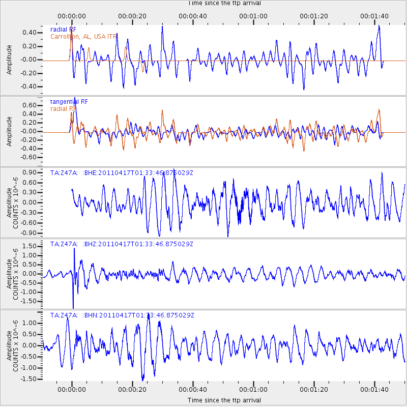
Z47A Carrollton, AL, USA - Earthquake Result Viewer
*The percent match for this event was below the threshold and hence no stack was calculated.
| Earthquake location: |
Santiago Del Estero Prov., Arg. |
| Earthquake latitude/longitude: |
-27.6/-63.2 |
| Earthquake time(UTC): |
2011/04/17 (107) 01:24:33 GMT |
| Earthquake Depth: |
563 km |
| Earthquake Magnitude: |
5.6 MD, 5.1 MB |
| Earthquake Catalog/Contributor: |
WHDF/NEIC |
|
| Network: |
TA USArray Transportable Network (new EarthScope stations) |
| Station: |
Z47A Carrollton, AL, USA |
| Lat/Lon: |
33.20 N/88.07 W |
| Elevation: |
65 m |
|
| Distance: |
64.9 deg |
| Az: |
337.082 deg |
| Baz: |
155.662 deg |
| Ray Param: |
$rayparam |
*The percent match for this event was below the threshold and hence was not used in the summary stack. |
|
| Radial Match: |
51.46003 % |
| Radial Bump: |
400 |
| Transverse Match: |
63.628193 % |
| Transverse Bump: |
400 |
| SOD ConfigId: |
356183 |
| Insert Time: |
2011-09-30 08:37:27.017 +0000 |
| GWidth: |
2.5 |
| Max Bumps: |
400 |
| Tol: |
0.001 |
|
Signal To Noise
| Channel | StoN | STA | LTA |
| TA:Z47A: :BHZ:20110417T01:33:46.875029Z | 3.1413083 | 5.935032E-7 | 1.8893503E-7 |
| TA:Z47A: :BHN:20110417T01:33:46.875029Z | 1.455135 | 4.9858687E-7 | 3.426396E-7 |
| TA:Z47A: :BHE:20110417T01:33:46.875029Z | 2.505104 | 6.0623967E-7 | 2.4200176E-7 |
| Arrivals |
| Ps | |
| PpPs | |
| PsPs/PpSs | |


