You are here: Home > Network List > US - United States National Seismic Network Stations List
> Station ERPA Erie, Pennsylvania, USA > Earthquake Result Viewer
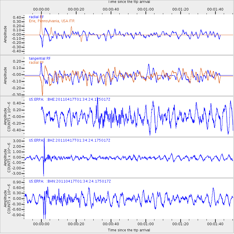
ERPA Erie, Pennsylvania, USA - Earthquake Result Viewer
*The percent match for this event was below the threshold and hence no stack was calculated.
| Earthquake location: |
Santiago Del Estero Prov., Arg. |
| Earthquake latitude/longitude: |
-27.6/-63.2 |
| Earthquake time(UTC): |
2011/04/17 (107) 01:24:33 GMT |
| Earthquake Depth: |
563 km |
| Earthquake Magnitude: |
5.6 MD, 5.1 MB |
| Earthquake Catalog/Contributor: |
WHDF/NEIC |
|
| Network: |
US United States National Seismic Network |
| Station: |
ERPA Erie, Pennsylvania, USA |
| Lat/Lon: |
42.12 N/79.99 W |
| Elevation: |
306 m |
|
| Distance: |
71.1 deg |
| Az: |
346.863 deg |
| Baz: |
164.272 deg |
| Ray Param: |
$rayparam |
*The percent match for this event was below the threshold and hence was not used in the summary stack. |
|
| Radial Match: |
51.120583 % |
| Radial Bump: |
400 |
| Transverse Match: |
46.15367 % |
| Transverse Bump: |
400 |
| SOD ConfigId: |
356183 |
| Insert Time: |
2011-09-30 08:44:34.540 +0000 |
| GWidth: |
2.5 |
| Max Bumps: |
400 |
| Tol: |
0.001 |
|
Signal To Noise
| Channel | StoN | STA | LTA |
| US:ERPA: :BHZ:20110417T01:34:24.175017Z | 4.2620606 | 9.308424E-7 | 2.1840198E-7 |
| US:ERPA: :BHN:20110417T01:34:24.175017Z | 1.8340411 | 3.6832017E-7 | 2.0082439E-7 |
| US:ERPA: :BHE:20110417T01:34:24.175017Z | 1.6032264 | 2.1774396E-7 | 1.358161E-7 |
| Arrivals |
| Ps | |
| PpPs | |
| PsPs/PpSs | |


