You are here: Home > Network List > CI - Caltech Regional Seismic Network Stations List
> Station SLA SLA, Trona, CA, USA > Earthquake Result Viewer
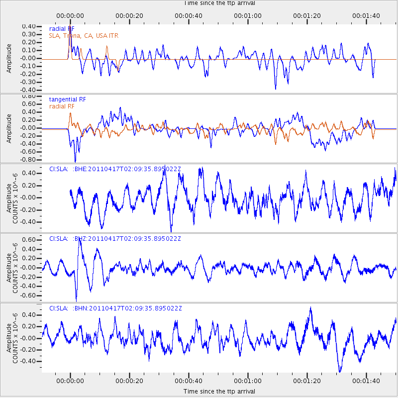
SLA SLA, Trona, CA, USA - Earthquake Result Viewer
*The percent match for this event was below the threshold and hence no stack was calculated.
| Earthquake location: |
Santiago Del Estero Prov., Arg. |
| Earthquake latitude/longitude: |
-27.6/-63.2 |
| Earthquake time(UTC): |
2011/04/17 (107) 01:58:49 GMT |
| Earthquake Depth: |
557 km |
| Earthquake Magnitude: |
5.6 MB, 5.9 MW, 5.8 MW |
| Earthquake Catalog/Contributor: |
WHDF/NEIC |
|
| Network: |
CI Caltech Regional Seismic Network |
| Station: |
SLA SLA, Trona, CA, USA |
| Lat/Lon: |
35.89 N/117.28 W |
| Elevation: |
1174 m |
|
| Distance: |
81.2 deg |
| Az: |
318.277 deg |
| Baz: |
133.33 deg |
| Ray Param: |
$rayparam |
*The percent match for this event was below the threshold and hence was not used in the summary stack. |
|
| Radial Match: |
54.222233 % |
| Radial Bump: |
400 |
| Transverse Match: |
53.05273 % |
| Transverse Bump: |
400 |
| SOD ConfigId: |
356183 |
| Insert Time: |
2011-09-30 09:09:49.922 +0000 |
| GWidth: |
2.5 |
| Max Bumps: |
400 |
| Tol: |
0.001 |
|
Signal To Noise
| Channel | StoN | STA | LTA |
| CI:SLA: :BHZ:20110417T02:09:35.895022Z | 4.4697924 | 3.3760725E-7 | 7.5530856E-8 |
| CI:SLA: :BHN:20110417T02:09:35.895022Z | 0.88243294 | 1.3422324E-7 | 1.5210587E-7 |
| CI:SLA: :BHE:20110417T02:09:35.895022Z | 1.879071 | 3.1564565E-7 | 1.6797964E-7 |
| Arrivals |
| Ps | |
| PpPs | |
| PsPs/PpSs | |


