You are here: Home > Network List > PE - Penn State Network Stations List
> Station PAGS PA Geological Survey > Earthquake Result Viewer
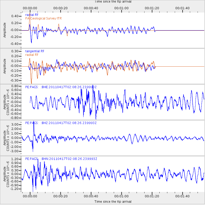
PAGS PA Geological Survey - Earthquake Result Viewer
*The percent match for this event was below the threshold and hence no stack was calculated.
| Earthquake location: |
Santiago Del Estero Prov., Arg. |
| Earthquake latitude/longitude: |
-27.6/-63.2 |
| Earthquake time(UTC): |
2011/04/17 (107) 01:58:49 GMT |
| Earthquake Depth: |
557 km |
| Earthquake Magnitude: |
5.6 MB, 5.9 MW, 5.8 MW |
| Earthquake Catalog/Contributor: |
WHDF/NEIC |
|
| Network: |
PE Penn State Network |
| Station: |
PAGS PA Geological Survey |
| Lat/Lon: |
40.23 N/76.72 W |
| Elevation: |
120 m |
|
| Distance: |
68.6 deg |
| Az: |
348.918 deg |
| Baz: |
167.126 deg |
| Ray Param: |
$rayparam |
*The percent match for this event was below the threshold and hence was not used in the summary stack. |
|
| Radial Match: |
55.51244 % |
| Radial Bump: |
400 |
| Transverse Match: |
61.82889 % |
| Transverse Bump: |
400 |
| SOD ConfigId: |
356183 |
| Insert Time: |
2011-09-30 09:34:24.202 +0000 |
| GWidth: |
2.5 |
| Max Bumps: |
400 |
| Tol: |
0.001 |
|
Signal To Noise
| Channel | StoN | STA | LTA |
| PE:PAGS: :BHZ:20110417T02:08:26.239993Z | 3.4366758 | 1.2236179E-6 | 3.5604694E-7 |
| PE:PAGS: :BHN:20110417T02:08:26.239993Z | 2.2904289 | 4.6123506E-7 | 2.0137497E-7 |
| PE:PAGS: :BHE:20110417T02:08:26.239993Z | 1.3254864 | 2.5935938E-7 | 1.9567109E-7 |
| Arrivals |
| Ps | |
| PpPs | |
| PsPs/PpSs | |


