You are here: Home > Network List > TA - USArray Transportable Network (new EarthScope stations) Stations List
> Station G30A Faulkton, SD, USA > Earthquake Result Viewer
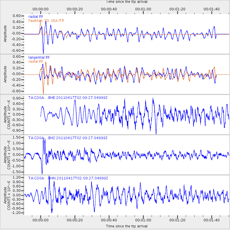
G30A Faulkton, SD, USA - Earthquake Result Viewer
*The percent match for this event was below the threshold and hence no stack was calculated.
| Earthquake location: |
Santiago Del Estero Prov., Arg. |
| Earthquake latitude/longitude: |
-27.6/-63.2 |
| Earthquake time(UTC): |
2011/04/17 (107) 01:58:49 GMT |
| Earthquake Depth: |
557 km |
| Earthquake Magnitude: |
5.6 MB, 5.9 MW, 5.8 MW |
| Earthquake Catalog/Contributor: |
WHDF/NEIC |
|
| Network: |
TA USArray Transportable Network (new EarthScope stations) |
| Station: |
G30A Faulkton, SD, USA |
| Lat/Lon: |
45.13 N/99.14 W |
| Elevation: |
496 m |
|
| Distance: |
79.4 deg |
| Az: |
334.997 deg |
| Baz: |
148.0 deg |
| Ray Param: |
$rayparam |
*The percent match for this event was below the threshold and hence was not used in the summary stack. |
|
| Radial Match: |
74.11684 % |
| Radial Bump: |
400 |
| Transverse Match: |
66.17864 % |
| Transverse Bump: |
400 |
| SOD ConfigId: |
356183 |
| Insert Time: |
2011-09-30 09:57:57.725 +0000 |
| GWidth: |
2.5 |
| Max Bumps: |
400 |
| Tol: |
0.001 |
|
Signal To Noise
| Channel | StoN | STA | LTA |
| TA:G30A: :BHZ:20110417T02:09:27.04999Z | 6.8141985 | 7.4757173E-7 | 1.0970795E-7 |
| TA:G30A: :BHN:20110417T02:09:27.04999Z | 1.6882406 | 3.6906462E-7 | 2.18609E-7 |
| TA:G30A: :BHE:20110417T02:09:27.04999Z | 0.961817 | 3.0512655E-7 | 3.172397E-7 |
| Arrivals |
| Ps | |
| PpPs | |
| PsPs/PpSs | |


