You are here: Home > Network List > PF - Volcanologic Network of Piton de Fournaise-OVPF Stations List
> Station HIM cratere Himiltrude > Earthquake Result Viewer
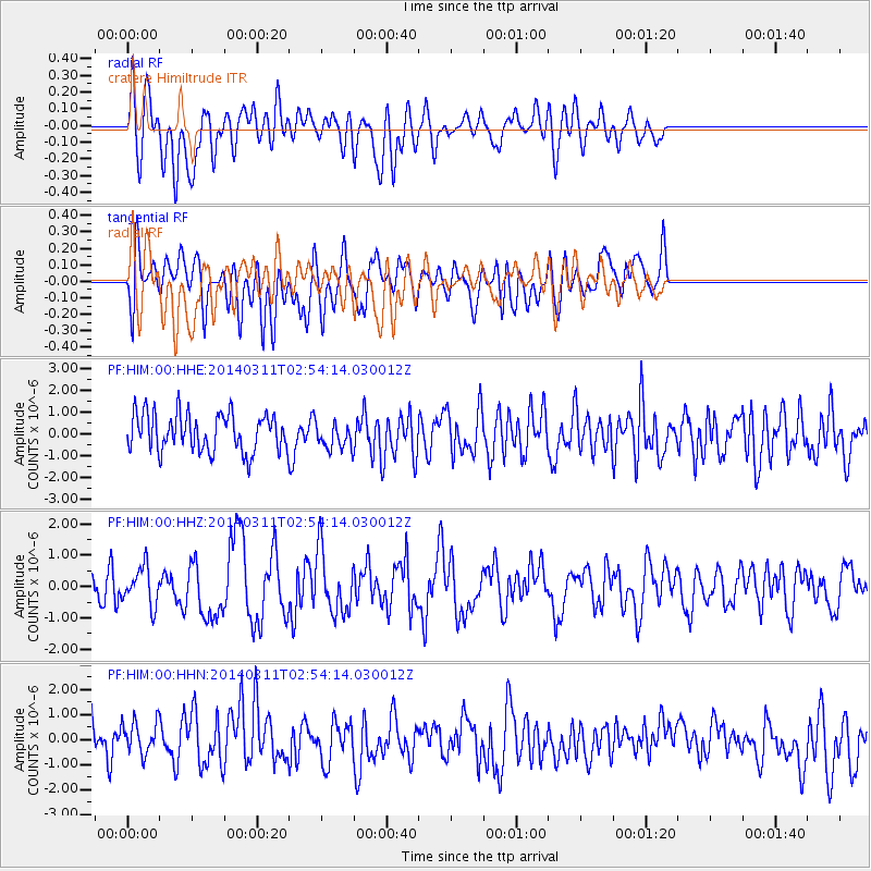
HIM cratere Himiltrude - Earthquake Result Viewer
*The percent match for this event was below the threshold and hence no stack was calculated.
| Earthquake location: |
East Of South Sandwich Islands |
| Earthquake latitude/longitude: |
-60.9/-20.0 |
| Earthquake time(UTC): |
2014/03/11 (070) 02:44:05 GMT |
| Earthquake Depth: |
10 km |
| Earthquake Magnitude: |
6.4 MWW, 6.4 MWB, 6.4 MWC, 6.8 MI |
| Earthquake Catalog/Contributor: |
NEIC PDE/NEIC COMCAT |
|
| Network: |
PF Volcanologic Network of Piton de Fournaise-OVPF |
| Station: |
HIM cratere Himiltrude |
| Lat/Lon: |
21.21 S/55.72 E |
| Elevation: |
1958 m |
|
| Distance: |
64.8 deg |
| Az: |
88.418 deg |
| Baz: |
211.622 deg |
| Ray Param: |
$rayparam |
*The percent match for this event was below the threshold and hence was not used in the summary stack. |
|
| Radial Match: |
55.27702 % |
| Radial Bump: |
400 |
| Transverse Match: |
43.587814 % |
| Transverse Bump: |
400 |
| SOD ConfigId: |
3390531 |
| Insert Time: |
2019-04-10 14:31:41.632 +0000 |
| GWidth: |
2.5 |
| Max Bumps: |
400 |
| Tol: |
0.001 |
|
Signal To Noise
| Channel | StoN | STA | LTA |
| PF:HIM:00:HHZ:20140311T02:54:14.030012Z | 1.1325464 | 6.1066737E-7 | 5.3919854E-7 |
| PF:HIM:00:HHN:20140311T02:54:14.030012Z | 0.9331077 | 7.635283E-7 | 8.1826386E-7 |
| PF:HIM:00:HHE:20140311T02:54:14.030012Z | 0.71054864 | 6.2001425E-7 | 8.7258525E-7 |
| Arrivals |
| Ps | |
| PpPs | |
| PsPs/PpSs | |


