You are here: Home > Network List > TA - USArray Transportable Network (new EarthScope stations) Stations List
> Station G32A Webster, SD, USA > Earthquake Result Viewer
G32A Webster, SD, USA - Earthquake Result Viewer
*The percent match for this event was below the threshold and hence no stack was calculated.
| Earthquake location: |
Santiago Del Estero Prov., Arg. |
| Earthquake latitude/longitude: |
-27.6/-63.2 |
| Earthquake time(UTC): |
2011/04/17 (107) 01:58:49 GMT |
| Earthquake Depth: |
557 km |
| Earthquake Magnitude: |
5.6 MB, 5.9 MW, 5.8 MW |
| Earthquake Catalog/Contributor: |
WHDF/NEIC |
|
| Network: |
TA USArray Transportable Network (new EarthScope stations) |
| Station: |
G32A Webster, SD, USA |
| Lat/Lon: |
45.26 N/97.50 W |
| Elevation: |
566 m |
|
| Distance: |
78.9 deg |
| Az: |
336.075 deg |
| Baz: |
149.365 deg |
| Ray Param: |
$rayparam |
*The percent match for this event was below the threshold and hence was not used in the summary stack. |
|
| Radial Match: |
54.641052 % |
| Radial Bump: |
378 |
| Transverse Match: |
51.559555 % |
| Transverse Bump: |
376 |
| SOD ConfigId: |
356183 |
| Insert Time: |
2011-09-30 11:12:04.355 +0000 |
| GWidth: |
2.5 |
| Max Bumps: |
400 |
| Tol: |
0.001 |
|
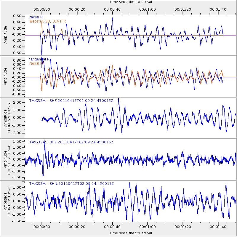
Signal To Noise
| Channel | StoN | STA | LTA |
| TA:G32A: :BHZ:20110417T02:09:24.450015Z | 3.1011808 | 6.2407486E-7 | 2.0123781E-7 |
| TA:G32A: :BHN:20110417T02:09:24.450015Z | 0.6893024 | 3.4787305E-7 | 5.046741E-7 |
| TA:G32A: :BHE:20110417T02:09:24.450015Z | 1.412149 | 8.39724E-7 | 5.9464264E-7 |
| Arrivals |
| Ps | |
| PpPs | |
| PsPs/PpSs | |


