You are here: Home > Network List > UW - Pacific Northwest Regional Seismic Network Stations List
> Station PASS Maple Falls, WA, USA > Earthquake Result Viewer
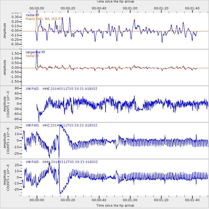
PASS Maple Falls, WA, USA - Earthquake Result Viewer
*The percent match for this event was below the threshold and hence no stack was calculated.
| Earthquake location: |
South Of Kermadec Islands |
| Earthquake latitude/longitude: |
-32.8/-178.1 |
| Earthquake time(UTC): |
2014/03/11 (070) 03:26:44 GMT |
| Earthquake Depth: |
34 km |
| Earthquake Magnitude: |
4.4 mb |
| Earthquake Catalog/Contributor: |
ISC/ISC |
|
| Network: |
UW Pacific Northwest Regional Seismic Network |
| Station: |
PASS Maple Falls, WA, USA |
| Lat/Lon: |
49.00 N/122.09 W |
| Elevation: |
174 m |
|
| Distance: |
95.4 deg |
| Az: |
33.246 deg |
| Baz: |
224.542 deg |
| Ray Param: |
$rayparam |
*The percent match for this event was below the threshold and hence was not used in the summary stack. |
|
| Radial Match: |
64.85663 % |
| Radial Bump: |
400 |
| Transverse Match: |
89.333244 % |
| Transverse Bump: |
291 |
| SOD ConfigId: |
3390531 |
| Insert Time: |
2019-04-10 14:37:07.112 +0000 |
| GWidth: |
2.5 |
| Max Bumps: |
400 |
| Tol: |
0.001 |
|
Signal To Noise
| Channel | StoN | STA | LTA |
| UW:PASS: :HHZ:20140311T03:39:33.91803Z | 0.43892896 | 9.938872E-6 | 2.2643462E-5 |
| UW:PASS: :HHN:20140311T03:39:33.91803Z | 0.43878365 | 1.0119644E-5 | 2.3062947E-5 |
| UW:PASS: :HHE:20140311T03:39:33.91803Z | 0.90264994 | 2.4855393E-5 | 2.7536027E-5 |
| Arrivals |
| Ps | |
| PpPs | |
| PsPs/PpSs | |


