You are here: Home > Network List > TA - USArray Transportable Network (new EarthScope stations) Stations List
> Station T38A Diamond, MO, USA > Earthquake Result Viewer
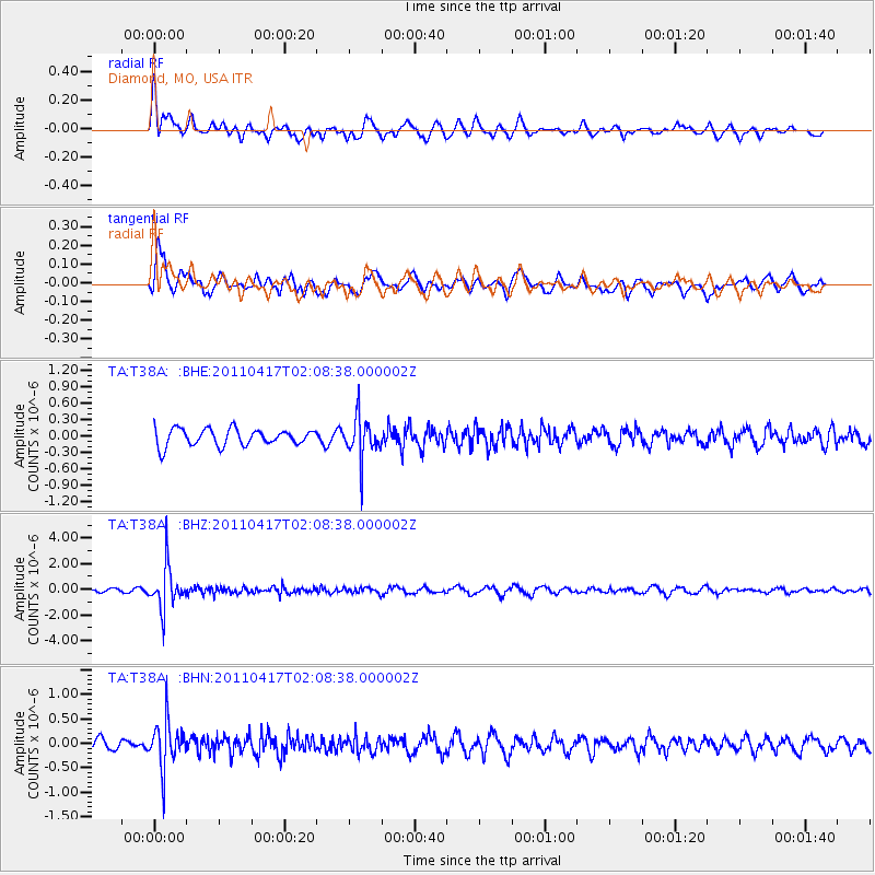
T38A Diamond, MO, USA - Earthquake Result Viewer
*The percent match for this event was below the threshold and hence no stack was calculated.
| Earthquake location: |
Santiago Del Estero Prov., Arg. |
| Earthquake latitude/longitude: |
-27.6/-63.2 |
| Earthquake time(UTC): |
2011/04/17 (107) 01:58:49 GMT |
| Earthquake Depth: |
557 km |
| Earthquake Magnitude: |
5.6 MB, 5.9 MW, 5.8 MW |
| Earthquake Catalog/Contributor: |
WHDF/NEIC |
|
| Network: |
TA USArray Transportable Network (new EarthScope stations) |
| Station: |
T38A Diamond, MO, USA |
| Lat/Lon: |
37.04 N/94.29 W |
| Elevation: |
349 m |
|
| Distance: |
70.6 deg |
| Az: |
334.02 deg |
| Baz: |
150.932 deg |
| Ray Param: |
$rayparam |
*The percent match for this event was below the threshold and hence was not used in the summary stack. |
|
| Radial Match: |
61.21906 % |
| Radial Bump: |
400 |
| Transverse Match: |
65.12153 % |
| Transverse Bump: |
400 |
| SOD ConfigId: |
356183 |
| Insert Time: |
2011-09-30 11:51:17.900 +0000 |
| GWidth: |
2.5 |
| Max Bumps: |
400 |
| Tol: |
0.001 |
|
Signal To Noise
| Channel | StoN | STA | LTA |
| TA:T38A: :BHZ:20110417T02:08:38.000002Z | 8.47806 | 1.5814649E-6 | 1.8653618E-7 |
| TA:T38A: :BHN:20110417T02:08:38.000002Z | 3.0409377 | 4.6591802E-7 | 1.5321525E-7 |
| TA:T38A: :BHE:20110417T02:08:38.000002Z | 2.506289 | 3.806147E-7 | 1.5186384E-7 |
| Arrivals |
| Ps | |
| PpPs | |
| PsPs/PpSs | |


