You are here: Home > Network List > TA - USArray Transportable Network (new EarthScope stations) Stations List
> Station 147A Livingston, AL, USA > Earthquake Result Viewer
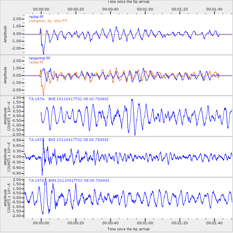
147A Livingston, AL, USA - Earthquake Result Viewer
*The percent match for this event was below the threshold and hence no stack was calculated.
| Earthquake location: |
Santiago Del Estero Prov., Arg. |
| Earthquake latitude/longitude: |
-27.6/-63.2 |
| Earthquake time(UTC): |
2011/04/17 (107) 01:58:49 GMT |
| Earthquake Depth: |
557 km |
| Earthquake Magnitude: |
5.6 MB, 5.9 MW, 5.8 MW |
| Earthquake Catalog/Contributor: |
WHDF/NEIC |
|
| Network: |
TA USArray Transportable Network (new EarthScope stations) |
| Station: |
147A Livingston, AL, USA |
| Lat/Lon: |
32.67 N/88.27 W |
| Elevation: |
57 m |
|
| Distance: |
64.5 deg |
| Az: |
336.677 deg |
| Baz: |
155.378 deg |
| Ray Param: |
$rayparam |
*The percent match for this event was below the threshold and hence was not used in the summary stack. |
|
| Radial Match: |
52.059063 % |
| Radial Bump: |
400 |
| Transverse Match: |
60.765385 % |
| Transverse Bump: |
364 |
| SOD ConfigId: |
356183 |
| Insert Time: |
2011-09-30 12:15:54.487 +0000 |
| GWidth: |
2.5 |
| Max Bumps: |
400 |
| Tol: |
0.001 |
|
Signal To Noise
| Channel | StoN | STA | LTA |
| TA:147A: :BHZ:20110417T02:08:00.79999Z | 4.113821 | 4.0533288E-7 | 9.852954E-8 |
| TA:147A: :BHN:20110417T02:08:00.79999Z | 2.704839 | 1.2855094E-6 | 4.7526282E-7 |
| TA:147A: :BHE:20110417T02:08:00.79999Z | 1.1351452 | 6.917229E-7 | 6.093695E-7 |
| Arrivals |
| Ps | |
| PpPs | |
| PsPs/PpSs | |


