You are here: Home > Network List > CI - Caltech Regional Seismic Network Stations List
> Station SMM Simmler, CA, USA > Earthquake Result Viewer
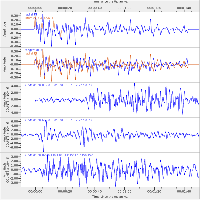
SMM Simmler, CA, USA - Earthquake Result Viewer
*The percent match for this event was below the threshold and hence no stack was calculated.
| Earthquake location: |
South Of Kermadec Islands |
| Earthquake latitude/longitude: |
-34.3/179.9 |
| Earthquake time(UTC): |
2011/04/18 (108) 13:03:02 GMT |
| Earthquake Depth: |
86 km |
| Earthquake Magnitude: |
6.2 MB, 6.6 MW, 6.5 MW |
| Earthquake Catalog/Contributor: |
WHDF/NEIC |
|
| Network: |
CI Caltech Regional Seismic Network |
| Station: |
SMM Simmler, CA, USA |
| Lat/Lon: |
35.31 N/120.00 W |
| Elevation: |
599 m |
|
| Distance: |
89.2 deg |
| Az: |
45.174 deg |
| Baz: |
225.86 deg |
| Ray Param: |
$rayparam |
*The percent match for this event was below the threshold and hence was not used in the summary stack. |
|
| Radial Match: |
87.13343 % |
| Radial Bump: |
400 |
| Transverse Match: |
79.15182 % |
| Transverse Bump: |
400 |
| SOD ConfigId: |
356183 |
| Insert Time: |
2011-09-30 12:57:31.517 +0000 |
| GWidth: |
2.5 |
| Max Bumps: |
400 |
| Tol: |
0.001 |
|
Signal To Noise
| Channel | StoN | STA | LTA |
| CI:SMM: :BHZ:20110418T13:15:17.745015Z | 4.655946 | 1.2509907E-6 | 2.686867E-7 |
| CI:SMM: :BHN:20110418T13:15:17.745015Z | 1.3146644 | 4.7978745E-7 | 3.6495052E-7 |
| CI:SMM: :BHE:20110418T13:15:17.745015Z | 1.2721025 | 4.3758558E-7 | 3.4398613E-7 |
| Arrivals |
| Ps | |
| PpPs | |
| PsPs/PpSs | |


