You are here: Home > Network List > G - GEOSCOPE Stations List
> Station INU Inuyama, Japan > Earthquake Result Viewer
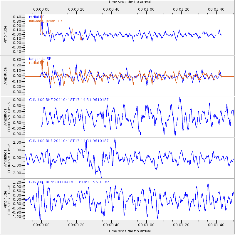
INU Inuyama, Japan - Earthquake Result Viewer
*The percent match for this event was below the threshold and hence no stack was calculated.
| Earthquake location: |
South Of Kermadec Islands |
| Earthquake latitude/longitude: |
-34.3/179.9 |
| Earthquake time(UTC): |
2011/04/18 (108) 13:03:02 GMT |
| Earthquake Depth: |
86 km |
| Earthquake Magnitude: |
6.2 MB, 6.6 MW, 6.5 MW |
| Earthquake Catalog/Contributor: |
WHDF/NEIC |
|
| Network: |
G GEOSCOPE |
| Station: |
INU Inuyama, Japan |
| Lat/Lon: |
35.35 N/137.03 E |
| Elevation: |
132 m |
|
| Distance: |
80.1 deg |
| Az: |
325.642 deg |
| Baz: |
145.16 deg |
| Ray Param: |
$rayparam |
*The percent match for this event was below the threshold and hence was not used in the summary stack. |
|
| Radial Match: |
63.123604 % |
| Radial Bump: |
400 |
| Transverse Match: |
65.95578 % |
| Transverse Bump: |
400 |
| SOD ConfigId: |
356183 |
| Insert Time: |
2011-09-30 13:02:14.118 +0000 |
| GWidth: |
2.5 |
| Max Bumps: |
400 |
| Tol: |
0.001 |
|
Signal To Noise
| Channel | StoN | STA | LTA |
| G:INU:00:BHZ:20110418T13:14:31.961018Z | 1.6459508 | 6.224033E-7 | 3.7814212E-7 |
| G:INU:00:BHN:20110418T13:14:31.961018Z | 3.5834968 | 8.162317E-7 | 2.2777522E-7 |
| G:INU:00:BHE:20110418T13:14:31.961018Z | 0.8980036 | 2.6313137E-7 | 2.930182E-7 |
| Arrivals |
| Ps | |
| PpPs | |
| PsPs/PpSs | |


