You are here: Home > Network List > TA - USArray Transportable Network (new EarthScope stations) Stations List
> Station G05D Wamic, OR, USA > Earthquake Result Viewer
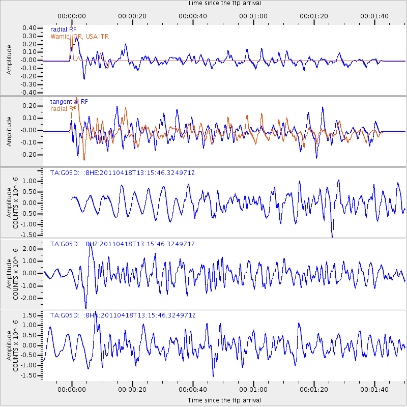
G05D Wamic, OR, USA - Earthquake Result Viewer
*The percent match for this event was below the threshold and hence no stack was calculated.
| Earthquake location: |
South Of Kermadec Islands |
| Earthquake latitude/longitude: |
-34.3/179.9 |
| Earthquake time(UTC): |
2011/04/18 (108) 13:03:02 GMT |
| Earthquake Depth: |
86 km |
| Earthquake Magnitude: |
6.2 MB, 6.6 MW, 6.5 MW |
| Earthquake Catalog/Contributor: |
WHDF/NEIC |
|
| Network: |
TA USArray Transportable Network (new EarthScope stations) |
| Station: |
G05D Wamic, OR, USA |
| Lat/Lon: |
45.24 N/121.32 W |
| Elevation: |
592 m |
|
| Distance: |
95.4 deg |
| Az: |
37.379 deg |
| Baz: |
225.322 deg |
| Ray Param: |
$rayparam |
*The percent match for this event was below the threshold and hence was not used in the summary stack. |
|
| Radial Match: |
58.261333 % |
| Radial Bump: |
400 |
| Transverse Match: |
48.416332 % |
| Transverse Bump: |
399 |
| SOD ConfigId: |
356183 |
| Insert Time: |
2011-09-30 13:10:07.087 +0000 |
| GWidth: |
2.5 |
| Max Bumps: |
400 |
| Tol: |
0.001 |
|
Signal To Noise
| Channel | StoN | STA | LTA |
| TA:G05D: :BHZ:20110418T13:15:46.324971Z | 3.9548473 | 1.0569939E-6 | 2.6726542E-7 |
| TA:G05D: :BHN:20110418T13:15:46.324971Z | 0.8206522 | 4.4768694E-7 | 5.455258E-7 |
| TA:G05D: :BHE:20110418T13:15:46.324971Z | 1.5251276 | 5.390338E-7 | 3.534352E-7 |
| Arrivals |
| Ps | |
| PpPs | |
| PsPs/PpSs | |


