You are here: Home > Network List > TA - USArray Transportable Network (new EarthScope stations) Stations List
> Station G03D McMinnville, OR, USA > Earthquake Result Viewer
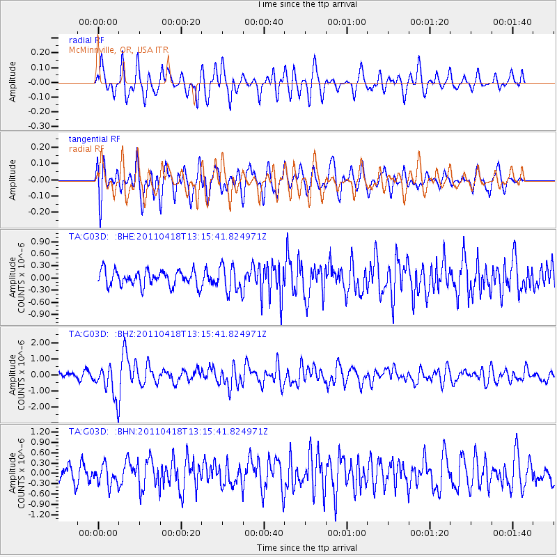
G03D McMinnville, OR, USA - Earthquake Result Viewer
*The percent match for this event was below the threshold and hence no stack was calculated.
| Earthquake location: |
South Of Kermadec Islands |
| Earthquake latitude/longitude: |
-34.3/179.9 |
| Earthquake time(UTC): |
2011/04/18 (108) 13:03:02 GMT |
| Earthquake Depth: |
86 km |
| Earthquake Magnitude: |
6.2 MB, 6.6 MW, 6.5 MW |
| Earthquake Catalog/Contributor: |
WHDF/NEIC |
|
| Network: |
TA USArray Transportable Network (new EarthScope stations) |
| Station: |
G03D McMinnville, OR, USA |
| Lat/Lon: |
45.21 N/123.26 W |
| Elevation: |
222 m |
|
| Distance: |
94.4 deg |
| Az: |
36.419 deg |
| Baz: |
224.027 deg |
| Ray Param: |
$rayparam |
*The percent match for this event was below the threshold and hence was not used in the summary stack. |
|
| Radial Match: |
74.834045 % |
| Radial Bump: |
400 |
| Transverse Match: |
69.29107 % |
| Transverse Bump: |
400 |
| SOD ConfigId: |
356183 |
| Insert Time: |
2011-09-30 13:10:38.763 +0000 |
| GWidth: |
2.5 |
| Max Bumps: |
400 |
| Tol: |
0.001 |
|
Signal To Noise
| Channel | StoN | STA | LTA |
| TA:G03D: :BHZ:20110418T13:15:41.824971Z | 6.042164 | 1.0310729E-6 | 1.706463E-7 |
| TA:G03D: :BHN:20110418T13:15:41.824971Z | 1.4405459 | 2.921949E-7 | 2.0283623E-7 |
| TA:G03D: :BHE:20110418T13:15:41.824971Z | 1.7905182 | 3.3743703E-7 | 1.8845775E-7 |
| Arrivals |
| Ps | |
| PpPs | |
| PsPs/PpSs | |


