You are here: Home > Network List > TA - USArray Transportable Network (new EarthScope stations) Stations List
> Station L04D Klamath Falls, OR, USA > Earthquake Result Viewer
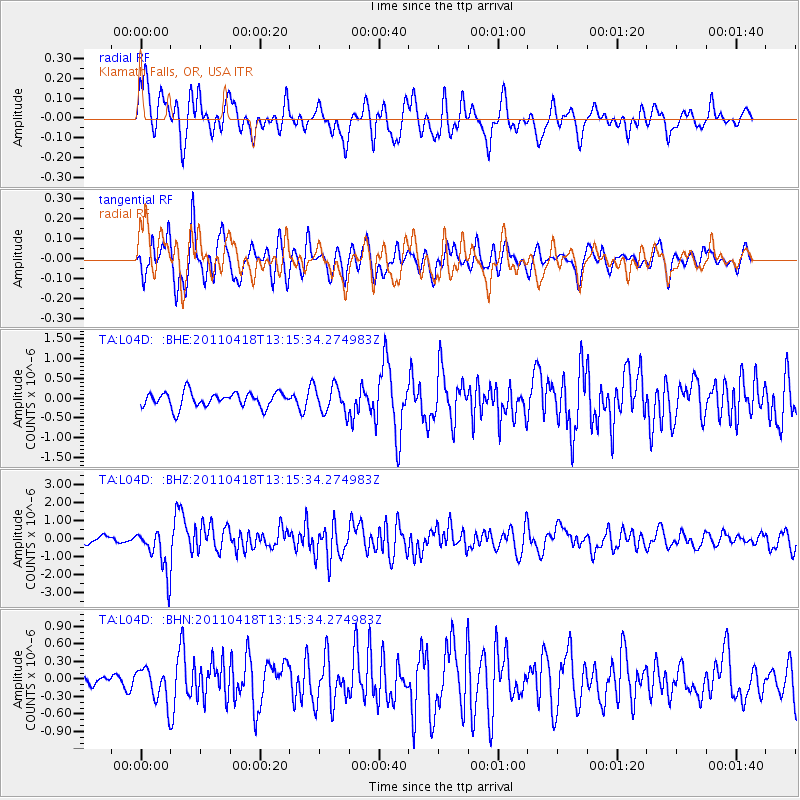
L04D Klamath Falls, OR, USA - Earthquake Result Viewer
*The percent match for this event was below the threshold and hence no stack was calculated.
| Earthquake location: |
South Of Kermadec Islands |
| Earthquake latitude/longitude: |
-34.3/179.9 |
| Earthquake time(UTC): |
2011/04/18 (108) 13:03:02 GMT |
| Earthquake Depth: |
86 km |
| Earthquake Magnitude: |
6.2 MB, 6.6 MW, 6.5 MW |
| Earthquake Catalog/Contributor: |
WHDF/NEIC |
|
| Network: |
TA USArray Transportable Network (new EarthScope stations) |
| Station: |
L04D Klamath Falls, OR, USA |
| Lat/Lon: |
42.22 N/122.30 W |
| Elevation: |
1437 m |
|
| Distance: |
92.8 deg |
| Az: |
39.011 deg |
| Baz: |
224.525 deg |
| Ray Param: |
$rayparam |
*The percent match for this event was below the threshold and hence was not used in the summary stack. |
|
| Radial Match: |
75.20912 % |
| Radial Bump: |
400 |
| Transverse Match: |
77.8254 % |
| Transverse Bump: |
400 |
| SOD ConfigId: |
356183 |
| Insert Time: |
2011-09-30 13:12:17.400 +0000 |
| GWidth: |
2.5 |
| Max Bumps: |
400 |
| Tol: |
0.001 |
|
Signal To Noise
| Channel | StoN | STA | LTA |
| TA:L04D: :BHZ:20110418T13:15:34.274983Z | 8.314488 | 1.2435352E-6 | 1.4956244E-7 |
| TA:L04D: :BHN:20110418T13:15:34.274983Z | 2.6214726 | 3.0263826E-7 | 1.154459E-7 |
| TA:L04D: :BHE:20110418T13:15:34.274983Z | 1.7989699 | 3.3914796E-7 | 1.8852342E-7 |
| Arrivals |
| Ps | |
| PpPs | |
| PsPs/PpSs | |


