You are here: Home > Network List > IU - Global Seismograph Network (GSN - IRIS/USGS) Stations List
> Station PMG Port Moresby, New Guinea > Earthquake Result Viewer
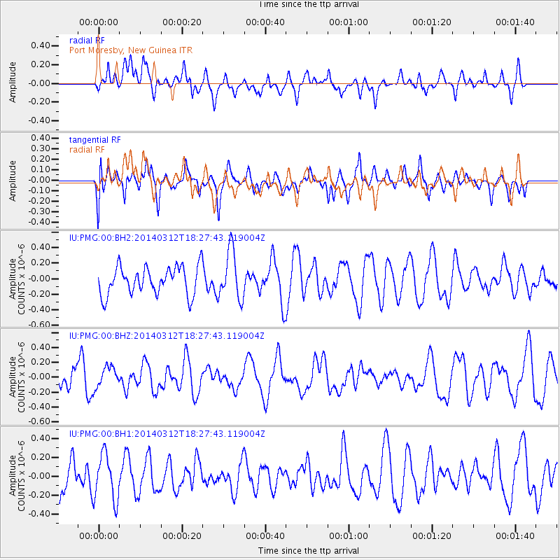
PMG Port Moresby, New Guinea - Earthquake Result Viewer
*The percent match for this event was below the threshold and hence no stack was calculated.
| Earthquake location: |
Northwest Of Kuril Islands |
| Earthquake latitude/longitude: |
52.0/153.2 |
| Earthquake time(UTC): |
2014/03/12 (071) 18:18:40 GMT |
| Earthquake Depth: |
418 km |
| Earthquake Magnitude: |
5.1 MW |
| Earthquake Catalog/Contributor: |
ISC/ISC |
|
| Network: |
IU Global Seismograph Network (GSN - IRIS/USGS) |
| Station: |
PMG Port Moresby, New Guinea |
| Lat/Lon: |
9.40 S/147.16 E |
| Elevation: |
90 m |
|
| Distance: |
61.4 deg |
| Az: |
186.787 deg |
| Baz: |
4.245 deg |
| Ray Param: |
$rayparam |
*The percent match for this event was below the threshold and hence was not used in the summary stack. |
|
| Radial Match: |
51.448494 % |
| Radial Bump: |
400 |
| Transverse Match: |
39.154285 % |
| Transverse Bump: |
400 |
| SOD ConfigId: |
3390531 |
| Insert Time: |
2019-04-10 14:46:05.807 +0000 |
| GWidth: |
2.5 |
| Max Bumps: |
400 |
| Tol: |
0.001 |
|
Signal To Noise
| Channel | StoN | STA | LTA |
| IU:PMG:00:BHZ:20140312T18:27:43.119004Z | 1.0263633 | 1.2743335E-7 | 1.241601E-7 |
| IU:PMG:00:BH1:20140312T18:27:43.119004Z | 1.8109798 | 2.4294312E-7 | 1.3415008E-7 |
| IU:PMG:00:BH2:20140312T18:27:43.119004Z | 1.7834591 | 3.1957364E-7 | 1.7918754E-7 |
| Arrivals |
| Ps | |
| PpPs | |
| PsPs/PpSs | |


