You are here: Home > Network List > UW - Pacific Northwest Regional Seismic Network Stations List
> Station YACT Amboy, WA, USA > Earthquake Result Viewer
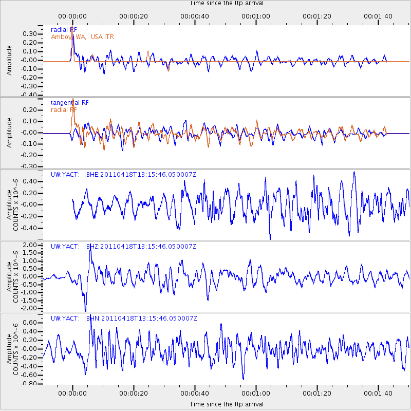
YACT Amboy, WA, USA - Earthquake Result Viewer
*The percent match for this event was below the threshold and hence no stack was calculated.
| Earthquake location: |
South Of Kermadec Islands |
| Earthquake latitude/longitude: |
-34.3/179.9 |
| Earthquake time(UTC): |
2011/04/18 (108) 13:03:02 GMT |
| Earthquake Depth: |
86 km |
| Earthquake Magnitude: |
6.2 MB, 6.6 MW, 6.5 MW |
| Earthquake Catalog/Contributor: |
WHDF/NEIC |
|
| Network: |
UW Pacific Northwest Regional Seismic Network |
| Station: |
YACT Amboy, WA, USA |
| Lat/Lon: |
45.93 N/122.42 W |
| Elevation: |
211 m |
|
| Distance: |
95.4 deg |
| Az: |
36.339 deg |
| Baz: |
224.635 deg |
| Ray Param: |
$rayparam |
*The percent match for this event was below the threshold and hence was not used in the summary stack. |
|
| Radial Match: |
74.89665 % |
| Radial Bump: |
400 |
| Transverse Match: |
67.97901 % |
| Transverse Bump: |
400 |
| SOD ConfigId: |
356183 |
| Insert Time: |
2011-09-30 13:21:08.357 +0000 |
| GWidth: |
2.5 |
| Max Bumps: |
400 |
| Tol: |
0.001 |
|
Signal To Noise
| Channel | StoN | STA | LTA |
| UW:YACT: :BHZ:20110418T13:15:46.050007Z | 8.375999 | 8.199869E-7 | 9.78972E-8 |
| UW:YACT: :BHN:20110418T13:15:46.050007Z | 2.2204397 | 2.293714E-7 | 1.0329999E-7 |
| UW:YACT: :BHE:20110418T13:15:46.050007Z | 1.6339189 | 1.9213364E-7 | 1.1759069E-7 |
| Arrivals |
| Ps | |
| PpPs | |
| PsPs/PpSs | |


