You are here: Home > Network List > UW - Pacific Northwest Regional Seismic Network Stations List
> Station MRBL Marblemount, WA, USA > Earthquake Result Viewer
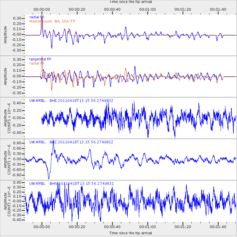
MRBL Marblemount, WA, USA - Earthquake Result Viewer
*The percent match for this event was below the threshold and hence no stack was calculated.
| Earthquake location: |
South Of Kermadec Islands |
| Earthquake latitude/longitude: |
-34.3/179.9 |
| Earthquake time(UTC): |
2011/04/18 (108) 13:03:02 GMT |
| Earthquake Depth: |
86 km |
| Earthquake Magnitude: |
6.2 MB, 6.6 MW, 6.5 MW |
| Earthquake Catalog/Contributor: |
WHDF/NEIC |
|
| Network: |
UW Pacific Northwest Regional Seismic Network |
| Station: |
MRBL Marblemount, WA, USA |
| Lat/Lon: |
48.52 N/121.48 W |
| Elevation: |
75 m |
|
| Distance: |
97.6 deg |
| Az: |
34.949 deg |
| Baz: |
225.477 deg |
| Ray Param: |
$rayparam |
*The percent match for this event was below the threshold and hence was not used in the summary stack. |
|
| Radial Match: |
69.65182 % |
| Radial Bump: |
400 |
| Transverse Match: |
72.85863 % |
| Transverse Bump: |
400 |
| SOD ConfigId: |
356183 |
| Insert Time: |
2011-09-30 13:21:26.192 +0000 |
| GWidth: |
2.5 |
| Max Bumps: |
400 |
| Tol: |
0.001 |
|
Signal To Noise
| Channel | StoN | STA | LTA |
| UW:MRBL: :BHZ:20110418T13:15:56.274983Z | 7.5588565 | 4.852796E-7 | 6.420014E-8 |
| UW:MRBL: :BHN:20110418T13:15:56.274983Z | 1.0063837 | 1.3037568E-7 | 1.295487E-7 |
| UW:MRBL: :BHE:20110418T13:15:56.274983Z | 1.2509668 | 1.3632322E-7 | 1.0897429E-7 |
| Arrivals |
| Ps | |
| PpPs | |
| PsPs/PpSs | |


