You are here: Home > Network List > TA - USArray Transportable Network (new EarthScope stations) Stations List
> Station P53A Whipple, OH, USA > Earthquake Result Viewer
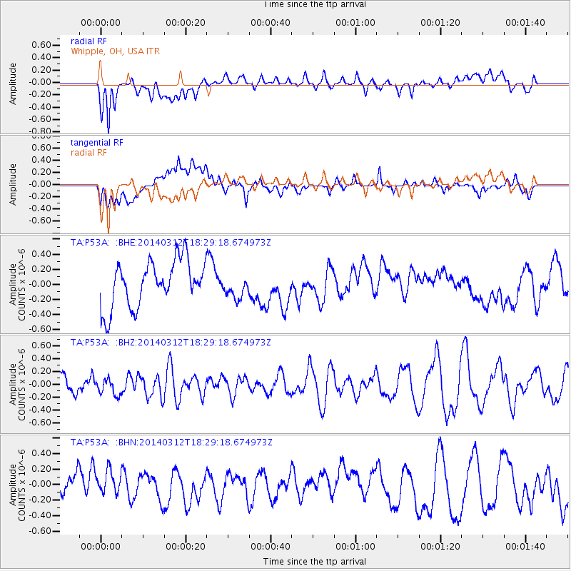
P53A Whipple, OH, USA - Earthquake Result Viewer
*The percent match for this event was below the threshold and hence no stack was calculated.
| Earthquake location: |
Northwest Of Kuril Islands |
| Earthquake latitude/longitude: |
52.0/153.2 |
| Earthquake time(UTC): |
2014/03/12 (071) 18:18:40 GMT |
| Earthquake Depth: |
418 km |
| Earthquake Magnitude: |
5.1 MW |
| Earthquake Catalog/Contributor: |
ISC/ISC |
|
| Network: |
TA USArray Transportable Network (new EarthScope stations) |
| Station: |
P53A Whipple, OH, USA |
| Lat/Lon: |
39.49 N/81.39 W |
| Elevation: |
270 m |
|
| Distance: |
77.2 deg |
| Az: |
40.287 deg |
| Baz: |
328.905 deg |
| Ray Param: |
$rayparam |
*The percent match for this event was below the threshold and hence was not used in the summary stack. |
|
| Radial Match: |
76.86221 % |
| Radial Bump: |
400 |
| Transverse Match: |
47.018826 % |
| Transverse Bump: |
400 |
| SOD ConfigId: |
3390531 |
| Insert Time: |
2019-04-10 14:49:29.415 +0000 |
| GWidth: |
2.5 |
| Max Bumps: |
400 |
| Tol: |
0.001 |
|
Signal To Noise
| Channel | StoN | STA | LTA |
| TA:P53A: :BHZ:20140312T18:29:18.674973Z | 0.5692348 | 1.2285304E-7 | 2.1582137E-7 |
| TA:P53A: :BHN:20140312T18:29:18.674973Z | 1.051492 | 1.9532291E-7 | 1.8575787E-7 |
| TA:P53A: :BHE:20140312T18:29:18.674973Z | 0.520488 | 1.5866769E-7 | 3.0484406E-7 |
| Arrivals |
| Ps | |
| PpPs | |
| PsPs/PpSs | |


