You are here: Home > Network List > TA - USArray Transportable Network (new EarthScope stations) Stations List
> Station G30A Faulkton, SD, USA > Earthquake Result Viewer
G30A Faulkton, SD, USA - Earthquake Result Viewer
*The percent match for this event was below the threshold and hence no stack was calculated.
| Earthquake location: |
Off East Coast Of Honshu, Japan |
| Earthquake latitude/longitude: |
40.3/143.5 |
| Earthquake time(UTC): |
2011/04/21 (111) 00:39:03 GMT |
| Earthquake Depth: |
10 km |
| Earthquake Magnitude: |
5.7 MW, 5.2 MS, 5.4 MB, 5.6 MW |
| Earthquake Catalog/Contributor: |
WHDF/NEIC |
|
| Network: |
TA USArray Transportable Network (new EarthScope stations) |
| Station: |
G30A Faulkton, SD, USA |
| Lat/Lon: |
45.13 N/99.14 W |
| Elevation: |
496 m |
|
| Distance: |
78.0 deg |
| Az: |
40.013 deg |
| Baz: |
316.033 deg |
| Ray Param: |
$rayparam |
*The percent match for this event was below the threshold and hence was not used in the summary stack. |
|
| Radial Match: |
54.429432 % |
| Radial Bump: |
400 |
| Transverse Match: |
62.233257 % |
| Transverse Bump: |
400 |
| SOD ConfigId: |
356183 |
| Insert Time: |
2011-09-30 14:07:08.029 +0000 |
| GWidth: |
2.5 |
| Max Bumps: |
400 |
| Tol: |
0.001 |
|
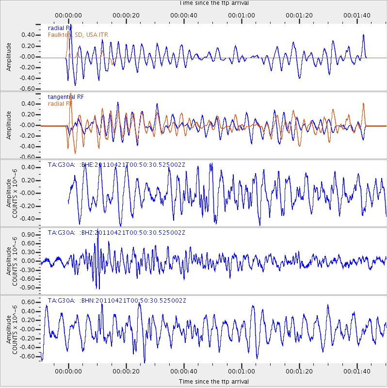
Signal To Noise
| Channel | StoN | STA | LTA |
| TA:G30A: :BHZ:20110421T00:50:30.525002Z | 1.9152726 | 1.8551584E-7 | 9.686133E-8 |
| TA:G30A: :BHN:20110421T00:50:30.525002Z | 0.73782307 | 2.3576756E-7 | 3.1954485E-7 |
| TA:G30A: :BHE:20110421T00:50:30.525002Z | 0.4948348 | 1.2187469E-7 | 2.462937E-7 |
| Arrivals |
| Ps | |
| PpPs | |
| PsPs/PpSs | |


