You are here: Home > Network List > TA - USArray Transportable Network (new EarthScope stations) Stations List
> Station M35A Neola, IA, USA > Earthquake Result Viewer
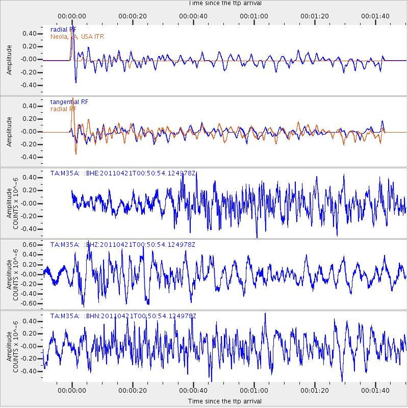
M35A Neola, IA, USA - Earthquake Result Viewer
*The percent match for this event was below the threshold and hence no stack was calculated.
| Earthquake location: |
Off East Coast Of Honshu, Japan |
| Earthquake latitude/longitude: |
40.3/143.5 |
| Earthquake time(UTC): |
2011/04/21 (111) 00:39:03 GMT |
| Earthquake Depth: |
10 km |
| Earthquake Magnitude: |
5.7 MW, 5.2 MS, 5.4 MB, 5.6 MW |
| Earthquake Catalog/Contributor: |
WHDF/NEIC |
|
| Network: |
TA USArray Transportable Network (new EarthScope stations) |
| Station: |
M35A Neola, IA, USA |
| Lat/Lon: |
41.47 N/95.69 W |
| Elevation: |
363 m |
|
| Distance: |
82.4 deg |
| Az: |
40.655 deg |
| Baz: |
318.501 deg |
| Ray Param: |
$rayparam |
*The percent match for this event was below the threshold and hence was not used in the summary stack. |
|
| Radial Match: |
63.93831 % |
| Radial Bump: |
400 |
| Transverse Match: |
68.57968 % |
| Transverse Bump: |
400 |
| SOD ConfigId: |
356183 |
| Insert Time: |
2011-09-30 14:11:27.234 +0000 |
| GWidth: |
2.5 |
| Max Bumps: |
400 |
| Tol: |
0.001 |
|
Signal To Noise
| Channel | StoN | STA | LTA |
| TA:M35A: :BHZ:20110421T00:50:54.124978Z | 2.822479 | 2.8729278E-7 | 1.01787386E-7 |
| TA:M35A: :BHN:20110421T00:50:54.124978Z | 1.1137626 | 1.3885142E-7 | 1.2466879E-7 |
| TA:M35A: :BHE:20110421T00:50:54.124978Z | 1.7691754 | 1.5355991E-7 | 8.679745E-8 |
| Arrivals |
| Ps | |
| PpPs | |
| PsPs/PpSs | |


