You are here: Home > Network List > TA - USArray Transportable Network (new EarthScope stations) Stations List
> Station Y59A Loris, SC, USA > Earthquake Result Viewer
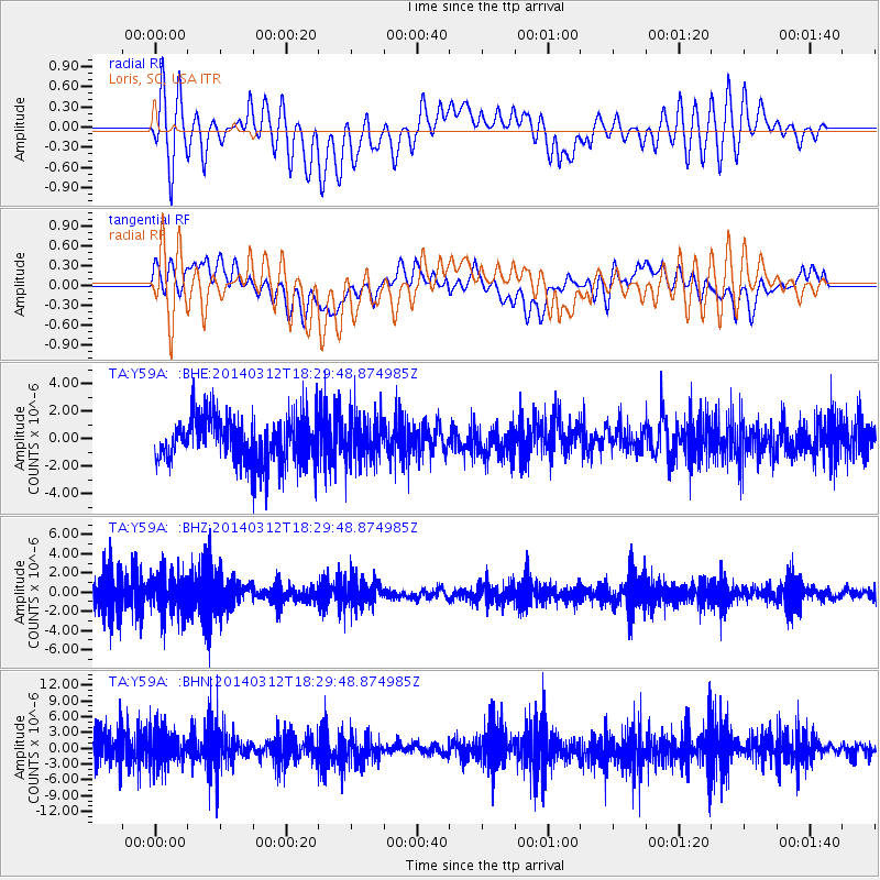
Y59A Loris, SC, USA - Earthquake Result Viewer
*The percent match for this event was below the threshold and hence no stack was calculated.
| Earthquake location: |
Northwest Of Kuril Islands |
| Earthquake latitude/longitude: |
52.0/153.2 |
| Earthquake time(UTC): |
2014/03/12 (071) 18:18:40 GMT |
| Earthquake Depth: |
418 km |
| Earthquake Magnitude: |
5.1 MW |
| Earthquake Catalog/Contributor: |
ISC/ISC |
|
| Network: |
TA USArray Transportable Network (new EarthScope stations) |
| Station: |
Y59A Loris, SC, USA |
| Lat/Lon: |
33.99 N/78.87 W |
| Elevation: |
2.0 m |
|
| Distance: |
83.0 deg |
| Az: |
41.32 deg |
| Baz: |
330.583 deg |
| Ray Param: |
$rayparam |
*The percent match for this event was below the threshold and hence was not used in the summary stack. |
|
| Radial Match: |
49.258587 % |
| Radial Bump: |
400 |
| Transverse Match: |
42.518456 % |
| Transverse Bump: |
400 |
| SOD ConfigId: |
3390531 |
| Insert Time: |
2019-04-10 14:50:02.368 +0000 |
| GWidth: |
2.5 |
| Max Bumps: |
400 |
| Tol: |
0.001 |
|
Signal To Noise
| Channel | StoN | STA | LTA |
| TA:Y59A: :BHZ:20140312T18:29:48.874985Z | 1.4505717 | 2.053357E-6 | 1.4155504E-6 |
| TA:Y59A: :BHN:20140312T18:29:48.874985Z | 1.0216525 | 3.2593996E-6 | 3.1903212E-6 |
| TA:Y59A: :BHE:20140312T18:29:48.874985Z | 0.96422786 | 1.6330591E-6 | 1.6936444E-6 |
| Arrivals |
| Ps | |
| PpPs | |
| PsPs/PpSs | |


