You are here: Home > Network List > TJ - Tajikistan National Seismic Network Stations List
> Station GARM Garm, Tajikistan > Earthquake Result Viewer
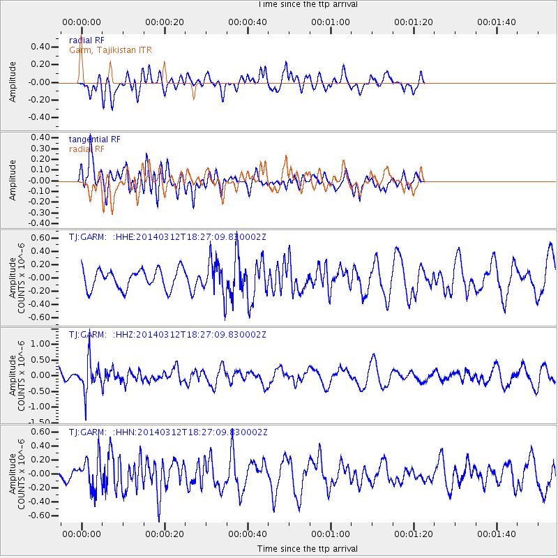
GARM Garm, Tajikistan - Earthquake Result Viewer
*The percent match for this event was below the threshold and hence no stack was calculated.
| Earthquake location: |
Northwest Of Kuril Islands |
| Earthquake latitude/longitude: |
52.0/153.2 |
| Earthquake time(UTC): |
2014/03/12 (071) 18:18:40 GMT |
| Earthquake Depth: |
418 km |
| Earthquake Magnitude: |
5.1 MW |
| Earthquake Catalog/Contributor: |
ISC/ISC |
|
| Network: |
TJ Tajikistan National Seismic Network |
| Station: |
GARM Garm, Tajikistan |
| Lat/Lon: |
39.00 N/70.32 E |
| Elevation: |
1305 m |
|
| Distance: |
56.5 deg |
| Az: |
291.94 deg |
| Baz: |
47.372 deg |
| Ray Param: |
$rayparam |
*The percent match for this event was below the threshold and hence was not used in the summary stack. |
|
| Radial Match: |
55.89875 % |
| Radial Bump: |
400 |
| Transverse Match: |
57.71164 % |
| Transverse Bump: |
400 |
| SOD ConfigId: |
3390531 |
| Insert Time: |
2019-04-10 14:50:07.265 +0000 |
| GWidth: |
2.5 |
| Max Bumps: |
400 |
| Tol: |
0.001 |
|
Signal To Noise
| Channel | StoN | STA | LTA |
| TJ:GARM: :HHZ:20140312T18:27:09.830002Z | 2.0469508 | 4.915922E-7 | 2.4015827E-7 |
| TJ:GARM: :HHN:20140312T18:27:09.830002Z | 1.8034834 | 2.2682703E-7 | 1.2577162E-7 |
| TJ:GARM: :HHE:20140312T18:27:09.830002Z | 1.7849894 | 2.6162382E-7 | 1.4656884E-7 |
| Arrivals |
| Ps | |
| PpPs | |
| PsPs/PpSs | |


