You are here: Home > Network List > US - United States National Seismic Network Stations List
> Station EGMT Eagleton, Montana, USA > Earthquake Result Viewer
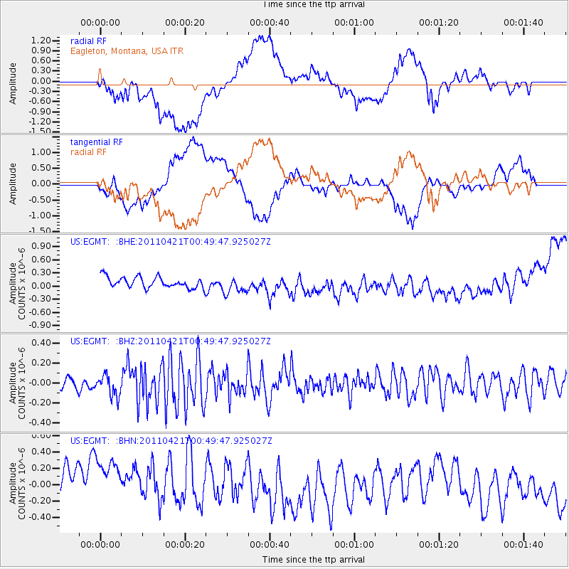
EGMT Eagleton, Montana, USA - Earthquake Result Viewer
*The percent match for this event was below the threshold and hence no stack was calculated.
| Earthquake location: |
Off East Coast Of Honshu, Japan |
| Earthquake latitude/longitude: |
40.3/143.5 |
| Earthquake time(UTC): |
2011/04/21 (111) 00:39:03 GMT |
| Earthquake Depth: |
10 km |
| Earthquake Magnitude: |
5.7 MW, 5.2 MS, 5.4 MB, 5.6 MW |
| Earthquake Catalog/Contributor: |
WHDF/NEIC |
|
| Network: |
US United States National Seismic Network |
| Station: |
EGMT Eagleton, Montana, USA |
| Lat/Lon: |
48.02 N/109.75 W |
| Elevation: |
1055 m |
|
| Distance: |
70.7 deg |
| Az: |
42.944 deg |
| Baz: |
309.13 deg |
| Ray Param: |
$rayparam |
*The percent match for this event was below the threshold and hence was not used in the summary stack. |
|
| Radial Match: |
36.904877 % |
| Radial Bump: |
400 |
| Transverse Match: |
36.913273 % |
| Transverse Bump: |
400 |
| SOD ConfigId: |
356183 |
| Insert Time: |
2011-09-30 14:22:53.541 +0000 |
| GWidth: |
2.5 |
| Max Bumps: |
400 |
| Tol: |
0.001 |
|
Signal To Noise
| Channel | StoN | STA | LTA |
| US:EGMT: :BHZ:20110421T00:49:47.925027Z | 1.0722674 | 1.06677284E-7 | 9.948758E-8 |
| US:EGMT: :BHN:20110421T00:49:47.925027Z | 1.5522659 | 5.816381E-7 | 3.7470264E-7 |
| US:EGMT: :BHE:20110421T00:49:47.925027Z | 1.6182314 | 2.0052521E-7 | 1.2391627E-7 |
| Arrivals |
| Ps | |
| PpPs | |
| PsPs/PpSs | |


