You are here: Home > Network List > AK - Alaska Regional Network Stations List
> Station MDM Murphy Dome > Earthquake Result Viewer
MDM Murphy Dome - Earthquake Result Viewer
*The percent match for this event was below the threshold and hence no stack was calculated.
| Earthquake location: |
Tonga Islands Region |
| Earthquake latitude/longitude: |
-22.8/-174.6 |
| Earthquake time(UTC): |
2011/04/22 (112) 17:14:51 GMT |
| Earthquake Depth: |
22 km |
| Earthquake Magnitude: |
5.5 MB, 5.2 MS, 5.5 MW |
| Earthquake Catalog/Contributor: |
WHDF/NEIC |
|
| Network: |
AK Alaska Regional Network |
| Station: |
MDM Murphy Dome |
| Lat/Lon: |
64.96 N/148.23 W |
| Elevation: |
634 m |
|
| Distance: |
89.8 deg |
| Az: |
10.894 deg |
| Baz: |
204.19 deg |
| Ray Param: |
$rayparam |
*The percent match for this event was below the threshold and hence was not used in the summary stack. |
|
| Radial Match: |
63.4521 % |
| Radial Bump: |
334 |
| Transverse Match: |
63.7419 % |
| Transverse Bump: |
400 |
| SOD ConfigId: |
356183 |
| Insert Time: |
2011-09-30 15:04:14.069 +0000 |
| GWidth: |
2.5 |
| Max Bumps: |
400 |
| Tol: |
0.001 |
|
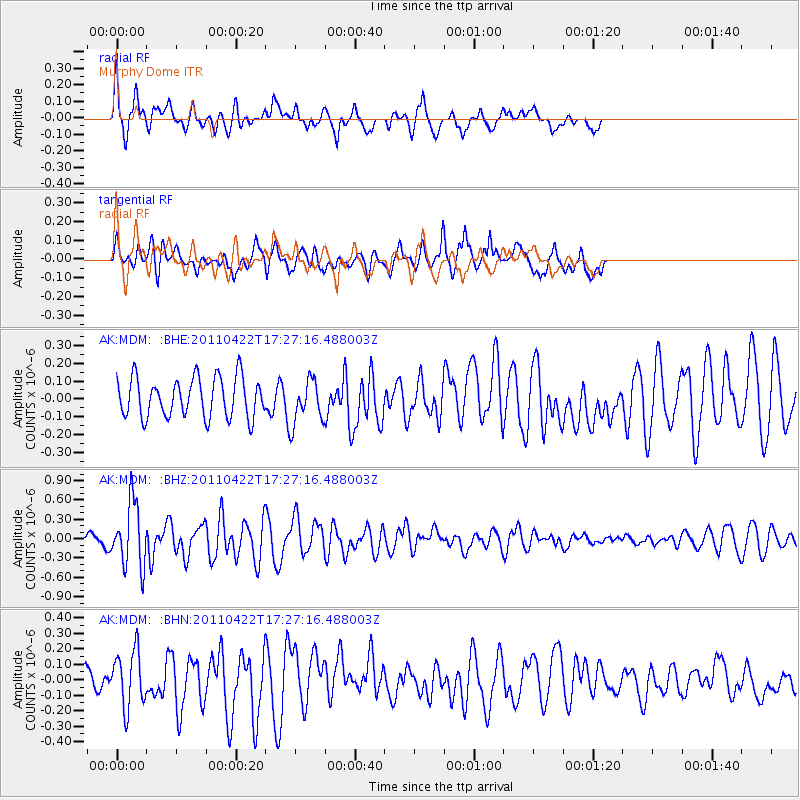
Signal To Noise
| Channel | StoN | STA | LTA |
| AK:MDM: :BHZ:20110422T17:27:16.488003Z | 6.1387205 | 4.943994E-7 | 8.053785E-8 |
| AK:MDM: :BHN:20110422T17:27:16.488003Z | 3.1188204 | 1.81757E-7 | 5.8277482E-8 |
| AK:MDM: :BHE:20110422T17:27:16.488003Z | 1.1321067 | 1.2622687E-7 | 1.1149732E-7 |
| Arrivals |
| Ps | |
| PpPs | |
| PsPs/PpSs | |


