You are here: Home > Network List > CI - Caltech Regional Seismic Network Stations List
> Station DAN Danby, California, USA > Earthquake Result Viewer
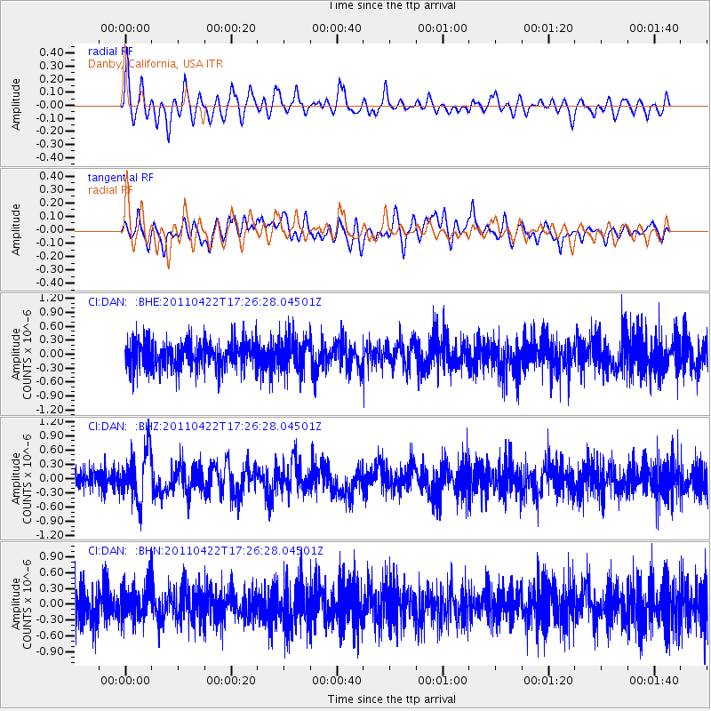
DAN Danby, California, USA - Earthquake Result Viewer
*The percent match for this event was below the threshold and hence no stack was calculated.
| Earthquake location: |
Tonga Islands Region |
| Earthquake latitude/longitude: |
-22.8/-174.6 |
| Earthquake time(UTC): |
2011/04/22 (112) 17:14:51 GMT |
| Earthquake Depth: |
22 km |
| Earthquake Magnitude: |
5.5 MB, 5.2 MS, 5.5 MW |
| Earthquake Catalog/Contributor: |
WHDF/NEIC |
|
| Network: |
CI Caltech Regional Seismic Network |
| Station: |
DAN Danby, California, USA |
| Lat/Lon: |
34.64 N/115.38 W |
| Elevation: |
398 m |
|
| Distance: |
80.1 deg |
| Az: |
45.97 deg |
| Baz: |
233.573 deg |
| Ray Param: |
$rayparam |
*The percent match for this event was below the threshold and hence was not used in the summary stack. |
|
| Radial Match: |
66.578804 % |
| Radial Bump: |
400 |
| Transverse Match: |
59.231167 % |
| Transverse Bump: |
400 |
| SOD ConfigId: |
356183 |
| Insert Time: |
2011-09-30 15:27:21.434 +0000 |
| GWidth: |
2.5 |
| Max Bumps: |
400 |
| Tol: |
0.001 |
|
Signal To Noise
| Channel | StoN | STA | LTA |
| CI:DAN: :BHZ:20110422T17:26:28.04501Z | 2.2897396 | 5.302158E-7 | 2.3156161E-7 |
| CI:DAN: :BHN:20110422T17:26:28.04501Z | 0.8969352 | 3.4949085E-7 | 3.8965004E-7 |
| CI:DAN: :BHE:20110422T17:26:28.04501Z | 1.2687552 | 3.663804E-7 | 2.8877153E-7 |
| Arrivals |
| Ps | |
| PpPs | |
| PsPs/PpSs | |


