You are here: Home > Network List > CI - Caltech Regional Seismic Network Stations List
> Station MPP McPhearson Peak > Earthquake Result Viewer
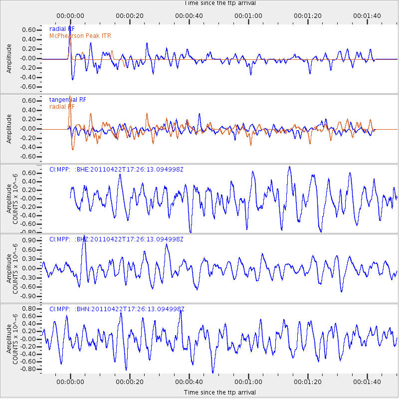
MPP McPhearson Peak - Earthquake Result Viewer
*The percent match for this event was below the threshold and hence no stack was calculated.
| Earthquake location: |
Tonga Islands Region |
| Earthquake latitude/longitude: |
-22.8/-174.6 |
| Earthquake time(UTC): |
2011/04/22 (112) 17:14:51 GMT |
| Earthquake Depth: |
22 km |
| Earthquake Magnitude: |
5.5 MB, 5.2 MS, 5.5 MW |
| Earthquake Catalog/Contributor: |
WHDF/NEIC |
|
| Network: |
CI Caltech Regional Seismic Network |
| Station: |
MPP McPhearson Peak |
| Lat/Lon: |
34.89 N/119.81 W |
| Elevation: |
1739 m |
|
| Distance: |
77.4 deg |
| Az: |
43.482 deg |
| Baz: |
230.571 deg |
| Ray Param: |
$rayparam |
*The percent match for this event was below the threshold and hence was not used in the summary stack. |
|
| Radial Match: |
75.22219 % |
| Radial Bump: |
400 |
| Transverse Match: |
47.251724 % |
| Transverse Bump: |
400 |
| SOD ConfigId: |
356183 |
| Insert Time: |
2011-09-30 15:29:13.207 +0000 |
| GWidth: |
2.5 |
| Max Bumps: |
400 |
| Tol: |
0.001 |
|
Signal To Noise
| Channel | StoN | STA | LTA |
| CI:MPP: :BHZ:20110422T17:26:13.094998Z | 3.3469734 | 4.4730444E-7 | 1.3364446E-7 |
| CI:MPP: :BHN:20110422T17:26:13.094998Z | 1.4222977 | 2.1973199E-7 | 1.5449085E-7 |
| CI:MPP: :BHE:20110422T17:26:13.094998Z | 0.93413496 | 2.1489531E-7 | 2.3004739E-7 |
| Arrivals |
| Ps | |
| PpPs | |
| PsPs/PpSs | |


