You are here: Home > Network List > CI - Caltech Regional Seismic Network Stations List
> Station BEL Belle Mtn, Joshua Tree National Park, CA, USA > Earthquake Result Viewer
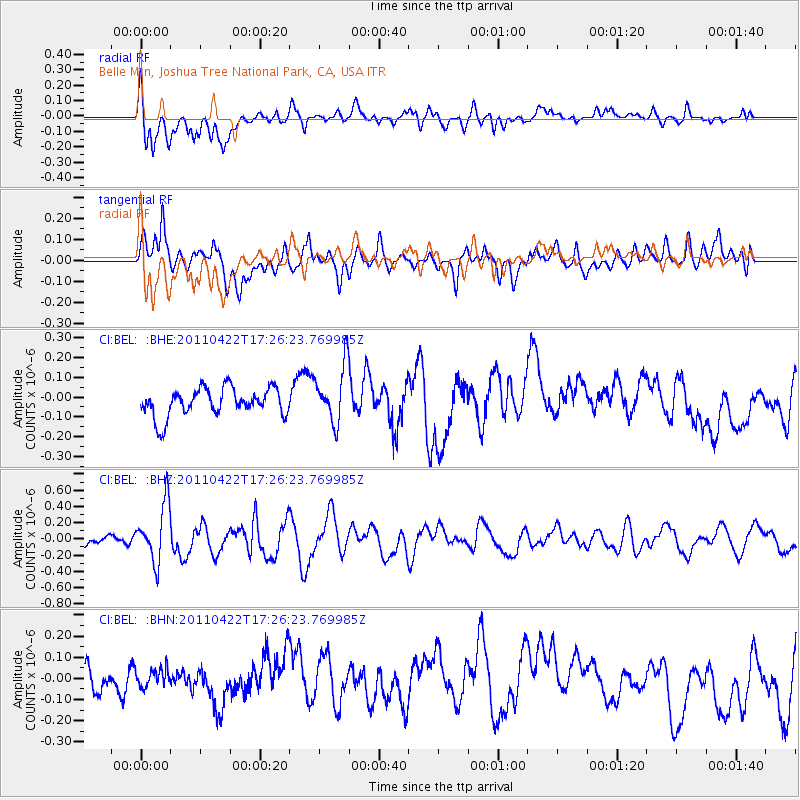
BEL Belle Mtn, Joshua Tree National Park, CA, USA - Earthquake Result Viewer
*The percent match for this event was below the threshold and hence no stack was calculated.
| Earthquake location: |
Tonga Islands Region |
| Earthquake latitude/longitude: |
-22.8/-174.6 |
| Earthquake time(UTC): |
2011/04/22 (112) 17:14:51 GMT |
| Earthquake Depth: |
22 km |
| Earthquake Magnitude: |
5.5 MB, 5.2 MS, 5.5 MW |
| Earthquake Catalog/Contributor: |
WHDF/NEIC |
|
| Network: |
CI Caltech Regional Seismic Network |
| Station: |
BEL Belle Mtn, Joshua Tree National Park, CA, USA |
| Lat/Lon: |
34.00 N/116.00 W |
| Elevation: |
1388 m |
|
| Distance: |
79.3 deg |
| Az: |
46.179 deg |
| Baz: |
233.263 deg |
| Ray Param: |
$rayparam |
*The percent match for this event was below the threshold and hence was not used in the summary stack. |
|
| Radial Match: |
61.937992 % |
| Radial Bump: |
400 |
| Transverse Match: |
47.81693 % |
| Transverse Bump: |
400 |
| SOD ConfigId: |
356183 |
| Insert Time: |
2011-09-30 15:29:48.827 +0000 |
| GWidth: |
2.5 |
| Max Bumps: |
400 |
| Tol: |
0.001 |
|
Signal To Noise
| Channel | StoN | STA | LTA |
| CI:BEL: :BHZ:20110422T17:26:23.769985Z | 4.944381 | 3.5102474E-7 | 7.099467E-8 |
| CI:BEL: :BHN:20110422T17:26:23.769985Z | 0.7563366 | 4.7868863E-8 | 6.329042E-8 |
| CI:BEL: :BHE:20110422T17:26:23.769985Z | 2.0676804 | 1.454843E-7 | 7.036112E-8 |
| Arrivals |
| Ps | |
| PpPs | |
| PsPs/PpSs | |


