You are here: Home > Network List > IW - Intermountain West Stations List
> Station MOOW Moose Ponds, Wyoming, USA > Earthquake Result Viewer
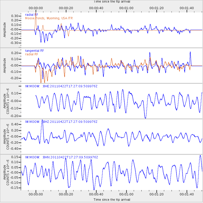
MOOW Moose Ponds, Wyoming, USA - Earthquake Result Viewer
*The percent match for this event was below the threshold and hence no stack was calculated.
| Earthquake location: |
Tonga Islands Region |
| Earthquake latitude/longitude: |
-22.8/-174.6 |
| Earthquake time(UTC): |
2011/04/22 (112) 17:14:51 GMT |
| Earthquake Depth: |
22 km |
| Earthquake Magnitude: |
5.5 MB, 5.2 MS, 5.5 MW |
| Earthquake Catalog/Contributor: |
WHDF/NEIC |
|
| Network: |
IW Intermountain West |
| Station: |
MOOW Moose Ponds, Wyoming, USA |
| Lat/Lon: |
43.75 N/110.74 W |
| Elevation: |
2128 m |
|
| Distance: |
88.3 deg |
| Az: |
40.6 deg |
| Baz: |
235.959 deg |
| Ray Param: |
$rayparam |
*The percent match for this event was below the threshold and hence was not used in the summary stack. |
|
| Radial Match: |
43.763947 % |
| Radial Bump: |
400 |
| Transverse Match: |
59.088924 % |
| Transverse Bump: |
400 |
| SOD ConfigId: |
356183 |
| Insert Time: |
2011-09-30 15:39:45.196 +0000 |
| GWidth: |
2.5 |
| Max Bumps: |
400 |
| Tol: |
0.001 |
|
Signal To Noise
| Channel | StoN | STA | LTA |
| IW:MOOW: :BHZ:20110422T17:27:09.509976Z | 2.8087056 | 2.353803E-7 | 8.380384E-8 |
| IW:MOOW: :BHN:20110422T17:27:09.509976Z | 0.85888183 | 5.1754895E-8 | 6.025846E-8 |
| IW:MOOW: :BHE:20110422T17:27:09.509976Z | 0.92080677 | 6.64591E-8 | 7.2174856E-8 |
| Arrivals |
| Ps | |
| PpPs | |
| PsPs/PpSs | |


