You are here: Home > Network List > TA - USArray Transportable Network (new EarthScope stations) Stations List
> Station J28A Allard Ranch, Norris, SD, USA > Earthquake Result Viewer
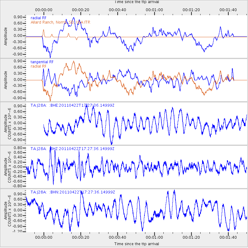
J28A Allard Ranch, Norris, SD, USA - Earthquake Result Viewer
*The percent match for this event was below the threshold and hence no stack was calculated.
| Earthquake location: |
Tonga Islands Region |
| Earthquake latitude/longitude: |
-22.8/-174.6 |
| Earthquake time(UTC): |
2011/04/22 (112) 17:14:51 GMT |
| Earthquake Depth: |
22 km |
| Earthquake Magnitude: |
5.5 MB, 5.2 MS, 5.5 MW |
| Earthquake Catalog/Contributor: |
WHDF/NEIC |
|
| Network: |
TA USArray Transportable Network (new EarthScope stations) |
| Station: |
J28A Allard Ranch, Norris, SD, USA |
| Lat/Lon: |
43.42 N/101.24 W |
| Elevation: |
835 m |
|
| Distance: |
94.1 deg |
| Az: |
44.415 deg |
| Baz: |
242.419 deg |
| Ray Param: |
$rayparam |
*The percent match for this event was below the threshold and hence was not used in the summary stack. |
|
| Radial Match: |
55.603928 % |
| Radial Bump: |
400 |
| Transverse Match: |
61.27387 % |
| Transverse Bump: |
400 |
| SOD ConfigId: |
356183 |
| Insert Time: |
2011-09-30 15:51:48.580 +0000 |
| GWidth: |
2.5 |
| Max Bumps: |
400 |
| Tol: |
0.001 |
|
Signal To Noise
| Channel | StoN | STA | LTA |
| TA:J28A: :BHZ:20110422T17:27:36.14999Z | 2.4316342 | 3.3952162E-7 | 1.3962692E-7 |
| TA:J28A: :BHN:20110422T17:27:36.14999Z | 0.58205616 | 2.5557546E-7 | 4.3909074E-7 |
| TA:J28A: :BHE:20110422T17:27:36.14999Z | 1.2784723 | 4.7653438E-7 | 3.7273736E-7 |
| Arrivals |
| Ps | |
| PpPs | |
| PsPs/PpSs | |


