You are here: Home > Network List > TA - USArray Transportable Network (new EarthScope stations) Stations List
> Station 535A Dale, TX, USA > Earthquake Result Viewer
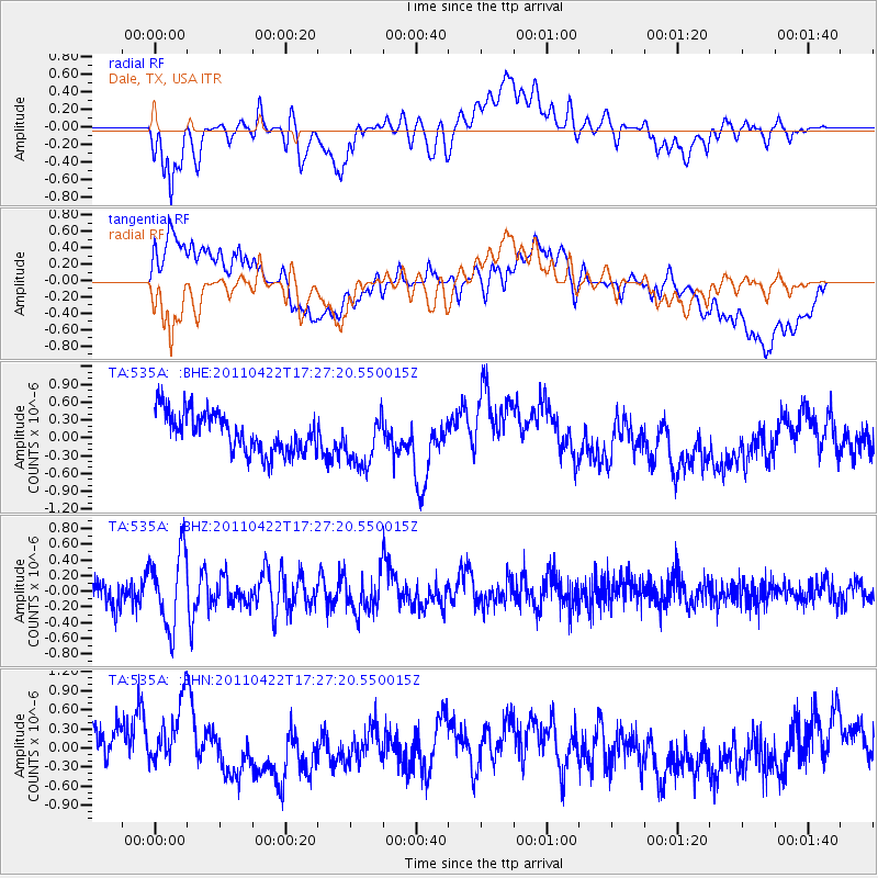
535A Dale, TX, USA - Earthquake Result Viewer
*The percent match for this event was below the threshold and hence no stack was calculated.
| Earthquake location: |
Tonga Islands Region |
| Earthquake latitude/longitude: |
-22.8/-174.6 |
| Earthquake time(UTC): |
2011/04/22 (112) 17:14:51 GMT |
| Earthquake Depth: |
22 km |
| Earthquake Magnitude: |
5.5 MB, 5.2 MS, 5.5 MW |
| Earthquake Catalog/Contributor: |
WHDF/NEIC |
|
| Network: |
TA USArray Transportable Network (new EarthScope stations) |
| Station: |
535A Dale, TX, USA |
| Lat/Lon: |
30.03 N/97.57 W |
| Elevation: |
170 m |
|
| Distance: |
90.7 deg |
| Az: |
57.686 deg |
| Baz: |
244.059 deg |
| Ray Param: |
$rayparam |
*The percent match for this event was below the threshold and hence was not used in the summary stack. |
|
| Radial Match: |
50.957092 % |
| Radial Bump: |
400 |
| Transverse Match: |
50.604057 % |
| Transverse Bump: |
400 |
| SOD ConfigId: |
356183 |
| Insert Time: |
2011-09-30 16:07:52.272 +0000 |
| GWidth: |
2.5 |
| Max Bumps: |
400 |
| Tol: |
0.001 |
|
Signal To Noise
| Channel | StoN | STA | LTA |
| TA:535A: :BHZ:20110422T17:27:20.550015Z | 2.6427944 | 4.7396892E-7 | 1.7934386E-7 |
| TA:535A: :BHN:20110422T17:27:20.550015Z | 1.5188922 | 6.186183E-7 | 4.0728256E-7 |
| TA:535A: :BHE:20110422T17:27:20.550015Z | 1.378579 | 4.565697E-7 | 3.3118863E-7 |
| Arrivals |
| Ps | |
| PpPs | |
| PsPs/PpSs | |


