You are here: Home > Network List > TA - USArray Transportable Network (new EarthScope stations) Stations List
> Station N34A Lincoln, NE, USA > Earthquake Result Viewer
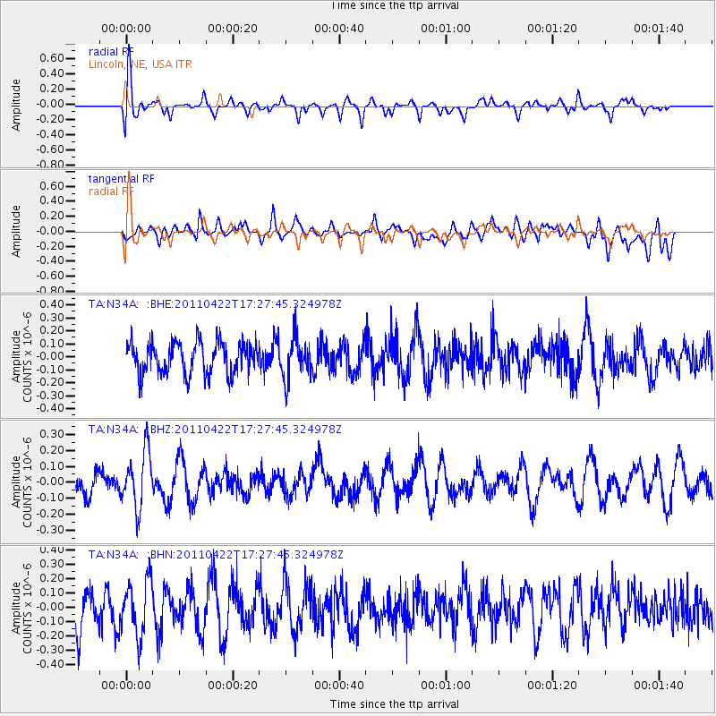
N34A Lincoln, NE, USA - Earthquake Result Viewer
*The percent match for this event was below the threshold and hence no stack was calculated.
| Earthquake location: |
Tonga Islands Region |
| Earthquake latitude/longitude: |
-22.8/-174.6 |
| Earthquake time(UTC): |
2011/04/22 (112) 17:14:51 GMT |
| Earthquake Depth: |
22 km |
| Earthquake Magnitude: |
5.5 MB, 5.2 MS, 5.5 MW |
| Earthquake Catalog/Contributor: |
WHDF/NEIC |
|
| Network: |
TA USArray Transportable Network (new EarthScope stations) |
| Station: |
N34A Lincoln, NE, USA |
| Lat/Lon: |
40.84 N/96.50 W |
| Elevation: |
401 m |
|
| Distance: |
96.1 deg |
| Az: |
48.301 deg |
| Baz: |
245.24 deg |
| Ray Param: |
$rayparam |
*The percent match for this event was below the threshold and hence was not used in the summary stack. |
|
| Radial Match: |
56.306538 % |
| Radial Bump: |
400 |
| Transverse Match: |
43.44073 % |
| Transverse Bump: |
400 |
| SOD ConfigId: |
356183 |
| Insert Time: |
2011-09-30 16:12:08.404 +0000 |
| GWidth: |
2.5 |
| Max Bumps: |
400 |
| Tol: |
0.001 |
|
Signal To Noise
| Channel | StoN | STA | LTA |
| TA:N34A: :BHZ:20110422T17:27:45.324978Z | 2.5579855 | 1.7772776E-7 | 6.9479576E-8 |
| TA:N34A: :BHN:20110422T17:27:45.324978Z | 1.2813383 | 1.9059708E-7 | 1.4874844E-7 |
| TA:N34A: :BHE:20110422T17:27:45.324978Z | 1.2399335 | 1.5139507E-7 | 1.2209935E-7 |
| Arrivals |
| Ps | |
| PpPs | |
| PsPs/PpSs | |


