You are here: Home > Network List > TA - USArray Transportable Network (new EarthScope stations) Stations List
> Station L04D Klamath Falls, OR, USA > Earthquake Result Viewer
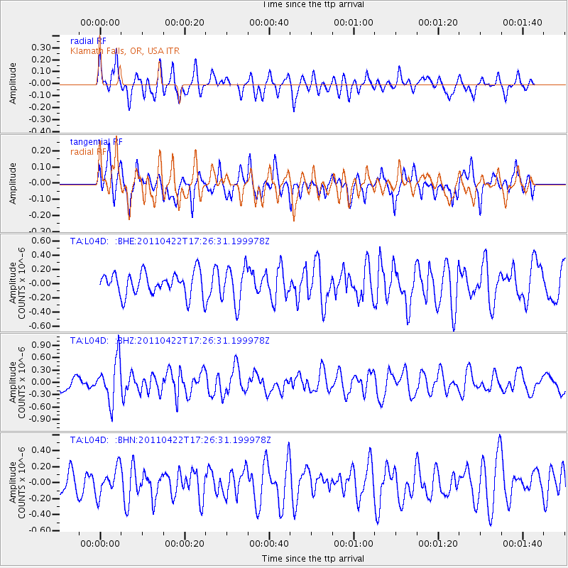
L04D Klamath Falls, OR, USA - Earthquake Result Viewer
*The percent match for this event was below the threshold and hence no stack was calculated.
| Earthquake location: |
Tonga Islands Region |
| Earthquake latitude/longitude: |
-22.8/-174.6 |
| Earthquake time(UTC): |
2011/04/22 (112) 17:14:51 GMT |
| Earthquake Depth: |
22 km |
| Earthquake Magnitude: |
5.5 MB, 5.2 MS, 5.5 MW |
| Earthquake Catalog/Contributor: |
WHDF/NEIC |
|
| Network: |
TA USArray Transportable Network (new EarthScope stations) |
| Station: |
L04D Klamath Falls, OR, USA |
| Lat/Lon: |
42.22 N/122.30 W |
| Elevation: |
1437 m |
|
| Distance: |
80.7 deg |
| Az: |
36.544 deg |
| Baz: |
227.703 deg |
| Ray Param: |
$rayparam |
*The percent match for this event was below the threshold and hence was not used in the summary stack. |
|
| Radial Match: |
50.263992 % |
| Radial Bump: |
400 |
| Transverse Match: |
70.83858 % |
| Transverse Bump: |
400 |
| SOD ConfigId: |
356183 |
| Insert Time: |
2011-09-30 16:14:30.593 +0000 |
| GWidth: |
2.5 |
| Max Bumps: |
400 |
| Tol: |
0.001 |
|
Signal To Noise
| Channel | StoN | STA | LTA |
| TA:L04D: :BHZ:20110422T17:26:31.199978Z | 4.168708 | 5.146936E-7 | 1.23466E-7 |
| TA:L04D: :BHN:20110422T17:26:31.199978Z | 1.1831934 | 1.7562223E-7 | 1.4843071E-7 |
| TA:L04D: :BHE:20110422T17:26:31.199978Z | 1.6652778 | 2.667037E-7 | 1.6015566E-7 |
| Arrivals |
| Ps | |
| PpPs | |
| PsPs/PpSs | |


