You are here: Home > Network List > US - United States National Seismic Network Stations List
> Station AMTX Amarillo, Texas, USA > Earthquake Result Viewer
AMTX Amarillo, Texas, USA - Earthquake Result Viewer
*The percent match for this event was below the threshold and hence no stack was calculated.
| Earthquake location: |
Tonga Islands Region |
| Earthquake latitude/longitude: |
-23.4/-175.4 |
| Earthquake time(UTC): |
2014/03/13 (072) 01:13:49 GMT |
| Earthquake Depth: |
43 km |
| Earthquake Magnitude: |
5.0 MW |
| Earthquake Catalog/Contributor: |
ISC/ISC |
|
| Network: |
US United States National Seismic Network |
| Station: |
AMTX Amarillo, Texas, USA |
| Lat/Lon: |
34.53 N/101.41 W |
| Elevation: |
1010 m |
|
| Distance: |
90.8 deg |
| Az: |
52.535 deg |
| Baz: |
242.007 deg |
| Ray Param: |
$rayparam |
*The percent match for this event was below the threshold and hence was not used in the summary stack. |
|
| Radial Match: |
58.368004 % |
| Radial Bump: |
400 |
| Transverse Match: |
50.559696 % |
| Transverse Bump: |
400 |
| SOD ConfigId: |
3390531 |
| Insert Time: |
2019-04-10 15:09:15.902 +0000 |
| GWidth: |
2.5 |
| Max Bumps: |
400 |
| Tol: |
0.001 |
|
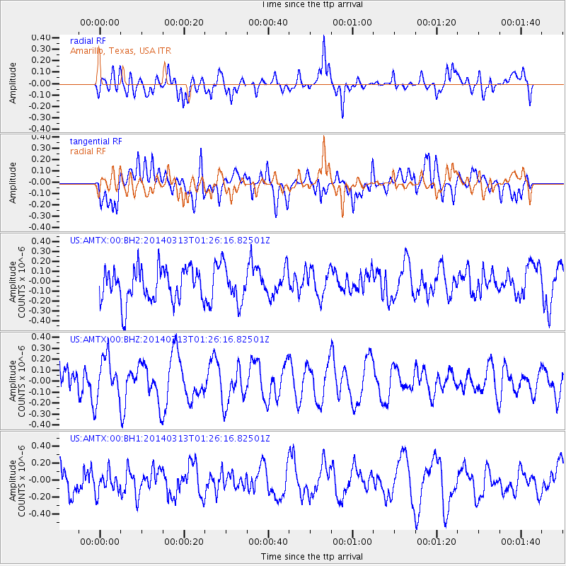
Signal To Noise
| Channel | StoN | STA | LTA |
| US:AMTX:00:BHZ:20140313T01:26:16.82501Z | 1.2168368 | 1.8624942E-7 | 1.5306031E-7 |
| US:AMTX:00:BH1:20140313T01:26:16.82501Z | 0.7860817 | 1.4383393E-7 | 1.8297581E-7 |
| US:AMTX:00:BH2:20140313T01:26:16.82501Z | 1.012485 | 1.694239E-7 | 1.6733473E-7 |
| Arrivals |
| Ps | |
| PpPs | |
| PsPs/PpSs | |


