You are here: Home > Network List > UW - Pacific Northwest Regional Seismic Network Stations List
> Station PASS Maple Falls, WA, USA > Earthquake Result Viewer
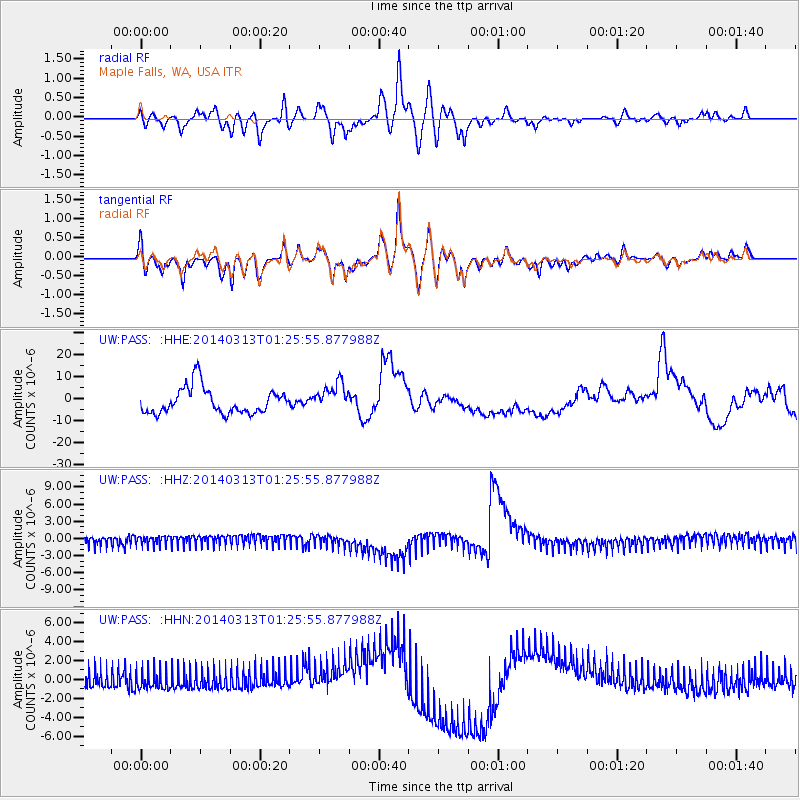
PASS Maple Falls, WA, USA - Earthquake Result Viewer
*The percent match for this event was below the threshold and hence no stack was calculated.
| Earthquake location: |
Tonga Islands Region |
| Earthquake latitude/longitude: |
-23.4/-175.4 |
| Earthquake time(UTC): |
2014/03/13 (072) 01:13:49 GMT |
| Earthquake Depth: |
43 km |
| Earthquake Magnitude: |
5.0 MW |
| Earthquake Catalog/Contributor: |
ISC/ISC |
|
| Network: |
UW Pacific Northwest Regional Seismic Network |
| Station: |
PASS Maple Falls, WA, USA |
| Lat/Lon: |
49.00 N/122.09 W |
| Elevation: |
174 m |
|
| Distance: |
86.4 deg |
| Az: |
31.96 deg |
| Baz: |
227.577 deg |
| Ray Param: |
$rayparam |
*The percent match for this event was below the threshold and hence was not used in the summary stack. |
|
| Radial Match: |
52.992657 % |
| Radial Bump: |
347 |
| Transverse Match: |
56.70932 % |
| Transverse Bump: |
384 |
| SOD ConfigId: |
3390531 |
| Insert Time: |
2019-04-10 15:09:40.609 +0000 |
| GWidth: |
2.5 |
| Max Bumps: |
400 |
| Tol: |
0.001 |
|
Signal To Noise
| Channel | StoN | STA | LTA |
| UW:PASS: :HHZ:20140313T01:25:55.877988Z | 0.81431186 | 8.586275E-7 | 1.054421E-6 |
| UW:PASS: :HHN:20140313T01:25:55.877988Z | 1.1120694 | 1.062311E-6 | 9.55256E-7 |
| UW:PASS: :HHE:20140313T01:25:55.877988Z | 1.0927078 | 6.3682746E-6 | 5.827976E-6 |
| Arrivals |
| Ps | |
| PpPs | |
| PsPs/PpSs | |


