You are here: Home > Network List > TA - USArray Transportable Network (new EarthScope stations) Stations List
> Station A04D Lummi Island, WA, USA > Earthquake Result Viewer
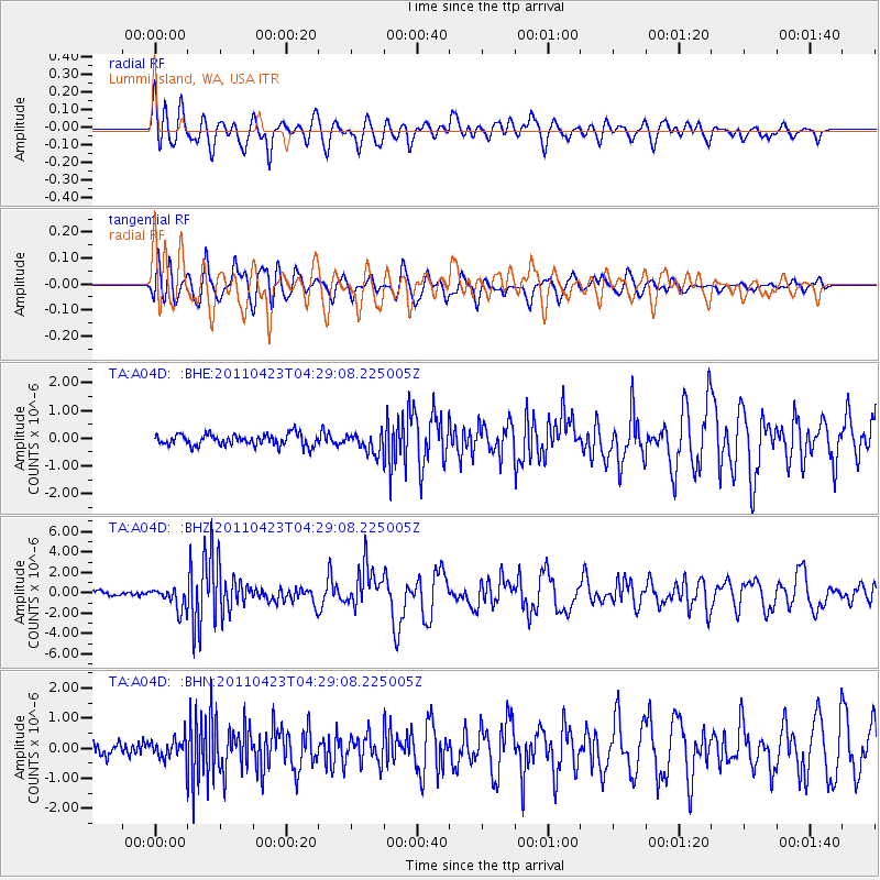
A04D Lummi Island, WA, USA - Earthquake Result Viewer
*The percent match for this event was below the threshold and hence no stack was calculated.
| Earthquake location: |
Solomon Islands |
| Earthquake latitude/longitude: |
-10.4/161.2 |
| Earthquake time(UTC): |
2011/04/23 (113) 04:16:54 GMT |
| Earthquake Depth: |
79 km |
| Earthquake Magnitude: |
6.7 MB, 6.8 MW, 6.8 MW |
| Earthquake Catalog/Contributor: |
WHDF/NEIC |
|
| Network: |
TA USArray Transportable Network (new EarthScope stations) |
| Station: |
A04D Lummi Island, WA, USA |
| Lat/Lon: |
48.72 N/122.71 W |
| Elevation: |
13 m |
|
| Distance: |
88.7 deg |
| Az: |
40.015 deg |
| Baz: |
252.798 deg |
| Ray Param: |
$rayparam |
*The percent match for this event was below the threshold and hence was not used in the summary stack. |
|
| Radial Match: |
83.75766 % |
| Radial Bump: |
400 |
| Transverse Match: |
81.85901 % |
| Transverse Bump: |
400 |
| SOD ConfigId: |
356183 |
| Insert Time: |
2011-10-01 03:37:13.712 +0000 |
| GWidth: |
2.5 |
| Max Bumps: |
400 |
| Tol: |
0.001 |
|
Signal To Noise
| Channel | StoN | STA | LTA |
| TA:A04D: :BHZ:20110423T04:29:08.225005Z | 5.906348 | 1.0804131E-6 | 1.8292404E-7 |
| TA:A04D: :BHN:20110423T04:29:08.225005Z | 1.473091 | 3.3779978E-7 | 2.2931359E-7 |
| TA:A04D: :BHE:20110423T04:29:08.225005Z | 1.7056154 | 3.556218E-7 | 2.085006E-7 |
| Arrivals |
| Ps | |
| PpPs | |
| PsPs/PpSs | |


