You are here: Home > Network List > UW - Pacific Northwest Regional Seismic Network Stations List
> Station GNW Green Mountain (BB) > Earthquake Result Viewer
GNW Green Mountain (BB) - Earthquake Result Viewer

| Earthquake location: |
Solomon Islands |
| Earthquake latitude/longitude: |
-10.4/161.2 |
| Earthquake time(UTC): |
2011/04/23 (113) 04:16:54 GMT |
| Earthquake Depth: |
79 km |
| Earthquake Magnitude: |
6.7 MB, 6.8 MW, 6.8 MW |
| Earthquake Catalog/Contributor: |
WHDF/NEIC |
|
| Network: |
UW Pacific Northwest Regional Seismic Network |
| Station: |
GNW Green Mountain (BB) |
| Lat/Lon: |
47.56 N/122.83 W |
| Elevation: |
160 m |
|
| Distance: |
88.3 deg |
| Az: |
41.097 deg |
| Baz: |
252.738 deg |
| Ray Param: |
0.04254079 |
| Estimated Moho Depth: |
17.25 km |
| Estimated Crust Vp/Vs: |
2.10 |
| Assumed Crust Vp: |
6.566 km/s |
| Estimated Crust Vs: |
3.13 km/s |
| Estimated Crust Poisson's Ratio: |
0.35 |
|
| Radial Match: |
91.70208 % |
| Radial Bump: |
400 |
| Transverse Match: |
86.39118 % |
| Transverse Bump: |
400 |
| SOD ConfigId: |
356183 |
| Insert Time: |
2011-10-01 03:47:22.174 +0000 |
| GWidth: |
2.5 |
| Max Bumps: |
400 |
| Tol: |
0.001 |
|
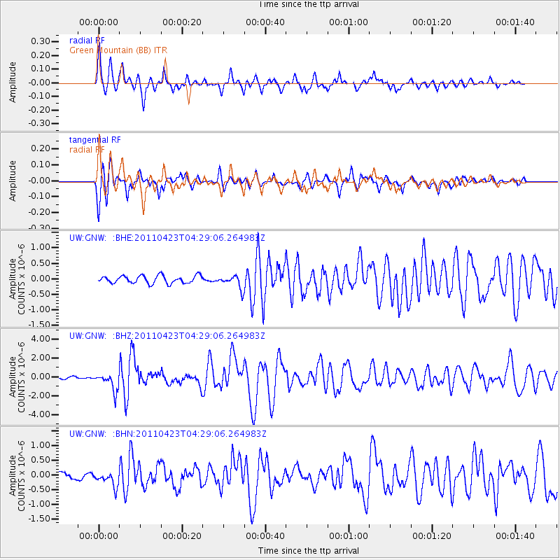
Signal To Noise
| Channel | StoN | STA | LTA |
| UW:GNW: :BHZ:20110423T04:29:06.264983Z | 10.278816 | 9.761187E-7 | 9.4964115E-8 |
| UW:GNW: :BHN:20110423T04:29:06.264983Z | 1.7129998 | 2.451222E-7 | 1.4309529E-7 |
| UW:GNW: :BHE:20110423T04:29:06.264983Z | 1.8427057 | 2.2377294E-7 | 1.2143715E-7 |
| Arrivals |
| Ps | 2.9 SECOND |
| PpPs | 8.0 SECOND |
| PsPs/PpSs | 11 SECOND |


