You are here: Home > Network List > IU - Global Seismograph Network (GSN - IRIS/USGS) Stations List
> Station RSSD Black Hills, South Dakota, USA > Earthquake Result Viewer
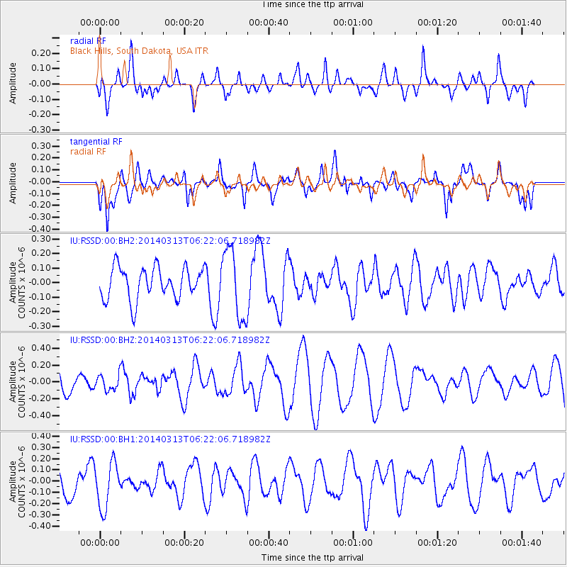
RSSD Black Hills, South Dakota, USA - Earthquake Result Viewer
*The percent match for this event was below the threshold and hence no stack was calculated.
| Earthquake location: |
Tonga Islands Region |
| Earthquake latitude/longitude: |
-23.4/-175.4 |
| Earthquake time(UTC): |
2014/03/13 (072) 06:09:23 GMT |
| Earthquake Depth: |
18 km |
| Earthquake Magnitude: |
5.3 MW |
| Earthquake Catalog/Contributor: |
ISC/ISC |
|
| Network: |
IU Global Seismograph Network (GSN - IRIS/USGS) |
| Station: |
RSSD Black Hills, South Dakota, USA |
| Lat/Lon: |
44.12 N/104.04 W |
| Elevation: |
2090 m |
|
| Distance: |
93.6 deg |
| Az: |
43.135 deg |
| Baz: |
240.726 deg |
| Ray Param: |
$rayparam |
*The percent match for this event was below the threshold and hence was not used in the summary stack. |
|
| Radial Match: |
52.633034 % |
| Radial Bump: |
400 |
| Transverse Match: |
61.163845 % |
| Transverse Bump: |
400 |
| SOD ConfigId: |
3390531 |
| Insert Time: |
2019-04-10 15:19:23.024 +0000 |
| GWidth: |
2.5 |
| Max Bumps: |
400 |
| Tol: |
0.001 |
|
Signal To Noise
| Channel | StoN | STA | LTA |
| IU:RSSD:00:BHZ:20140313T06:22:06.718982Z | 0.5976438 | 9.459166E-8 | 1.5827432E-7 |
| IU:RSSD:00:BH1:20140313T06:22:06.718982Z | 1.0403719 | 2.0536653E-7 | 1.9739724E-7 |
| IU:RSSD:00:BH2:20140313T06:22:06.718982Z | 2.1993716 | 2.390664E-7 | 1.086976E-7 |
| Arrivals |
| Ps | |
| PpPs | |
| PsPs/PpSs | |


