You are here: Home > Network List > US - United States National Seismic Network Stations List
> Station MSO Missoula, Montana, USA > Earthquake Result Viewer
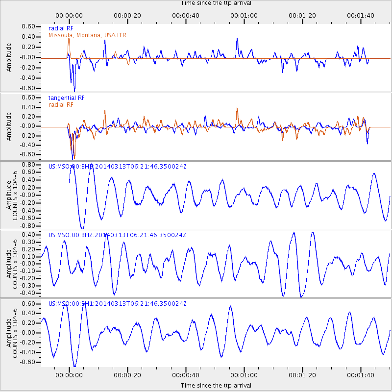
MSO Missoula, Montana, USA - Earthquake Result Viewer
*The percent match for this event was below the threshold and hence no stack was calculated.
| Earthquake location: |
Tonga Islands Region |
| Earthquake latitude/longitude: |
-23.4/-175.4 |
| Earthquake time(UTC): |
2014/03/13 (072) 06:09:23 GMT |
| Earthquake Depth: |
18 km |
| Earthquake Magnitude: |
5.3 MW |
| Earthquake Catalog/Contributor: |
ISC/ISC |
|
| Network: |
US United States National Seismic Network |
| Station: |
MSO Missoula, Montana, USA |
| Lat/Lon: |
46.83 N/113.94 W |
| Elevation: |
1264 m |
|
| Distance: |
89.2 deg |
| Az: |
37.098 deg |
| Baz: |
233.821 deg |
| Ray Param: |
$rayparam |
*The percent match for this event was below the threshold and hence was not used in the summary stack. |
|
| Radial Match: |
66.41653 % |
| Radial Bump: |
358 |
| Transverse Match: |
63.37723 % |
| Transverse Bump: |
400 |
| SOD ConfigId: |
3390531 |
| Insert Time: |
2019-04-10 15:21:39.374 +0000 |
| GWidth: |
2.5 |
| Max Bumps: |
400 |
| Tol: |
0.001 |
|
Signal To Noise
| Channel | StoN | STA | LTA |
| US:MSO:00:BHZ:20140313T06:21:46.350024Z | 0.367048 | 9.83627E-8 | 2.679832E-7 |
| US:MSO:00:BH1:20140313T06:21:46.350024Z | 2.4446793 | 4.5231158E-7 | 1.8501878E-7 |
| US:MSO:00:BH2:20140313T06:21:46.350024Z | 0.32127675 | 1.4602227E-7 | 4.5450622E-7 |
| Arrivals |
| Ps | |
| PpPs | |
| PsPs/PpSs | |


