
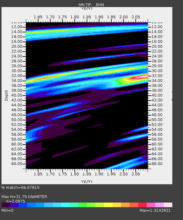
TIP Timpagrande, Italy - Earthquake Result Viewer
| ||||||||||||||||||
| ||||||||||||||||||
| ||||||||||||||||||
|
Signal To Noise
| Channel | StoN | STA | LTA |
| MN:TIP: :BHZ:20110423T10:25:01.651997Z | 17.324802 | 7.7460413E-7 | 4.4710706E-8 |
| MN:TIP: :BHN:20110423T10:25:01.651997Z | 1.6812997 | 1.2152933E-7 | 7.2282965E-8 |
| MN:TIP: :BHE:20110423T10:25:01.651997Z | 3.9569857 | 2.1292628E-7 | 5.3810222E-8 |
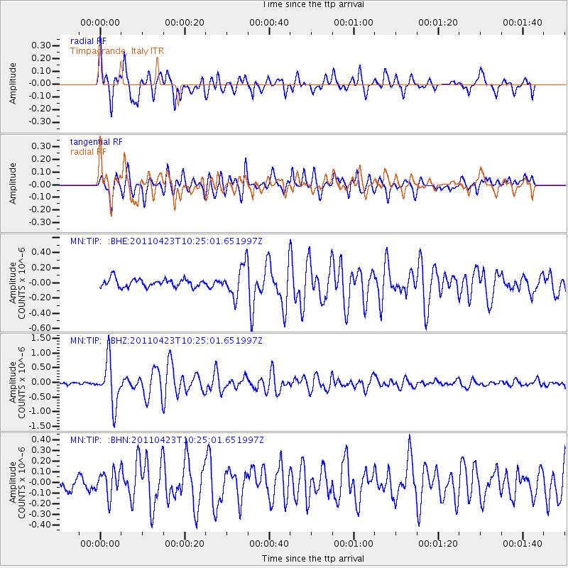
| Arrivals | |
| Ps | 5.8 SECOND |
| PpPs | 16 SECOND |
| PsPs/PpSs | 22 SECOND |

